Senheim geodata
Senheim (Rheinland-Pfalz) is a seat of a fourth-order administrative division; located in Germany in Europe/Berlin (GMT+2) time zone. With population of 606 people, there are 8780 cities with bigger population in this country. Compared to other cities in Germany, 61.8% of cities are located further ↑North; 91.2% of cities are located further →East and 60.5% of cities have lower elevation than Senheim. Note1
Administrative division(s):
- Level 1: Rheinland-Pfalz
- Level 3: Landkreis Cochem-Zell
- Level 4: Senheim


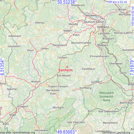
Senheim GPS coordinates[2]
50° 4' 59.988" North, 7° 13' 0.012" East
| Map corner | latitude | longitude |
|---|---|---|
| Upper-left | 50.53238°, | 6.51354° |
| Center: | 50.08333°, | 7.21667° |
| Lower-right: | 49.63003°, | 7.91979° |
| Map W x H: | 100.3×100.3 km | = 62.3×62.3mi |
| max Lat: | 55.01917° ⇑61.8% North |
| Senheim: | 50.08333° |
| min Lat: | ⇓38.2% South 47.40724° |
| min Long | Senheim | max Long |
| 5.92978° | 7.21667° | 14.98853° |
| W 8.8%⇐ | ⇒91.2% E |
Elevation
Elevation of Senheim is 293 m = 961 ft, and this is 43.9 m = 144 ft above average elevation for this country.
| Max E: |
1256 m = 4121 ft | 39.5% |
| Senheim | 293 m 961 ft | |
| Avg. | 249.1 m = 817 ft | |
Min E: |
-5 m = -16 ft | 60.5% |
See also: Germany elevation on elevation.city.
Geographical zone
Senheim is located in North temperate zone (between Tropic of Cancer and the Arctic Circle). Distance of this North polar circle is 1832.4 km =1138.6 mi to North.| Distance of | km | miles | from Senheim |
|---|---|---|---|
| North Pole | 4438.3 | 2757.8 | to North |
| Arctic Circle | 1832.4 | 1138.6 | to North |
| Tropic Cancer | 2962.8 | 1841 | to South |
| Equator | 5568.7 | 3460.2 | to South |


Nearby cities:
15 places around Senheim: (largest is in red/bold)
• Altstrimmig
6.2 km =3.9 mi,  72°
72°
• Beilstein
4.4 km =2.7 mi,  32°
32°
• Briedern
2.2 km =1.4 mi,  327°
327°
• Bruttig-Fankel
5.7 km =3.5 mi,  12°
12°
• Ediger-Eller
6 km =3.7 mi,  307°
307°
• Ellenz-Poltersdorf
2.2 km =1.4 mi, 32°
• Grenderich
2.2 km =1.4 mi,  147°
147°
• Hesweiler
6 km =3.7 mi,  127°
127°
• Liesenich
4.8 km =3 mi,  90°
90°
• Mesenich
2.2 km =1.4 mi, 327°
• Mittelstrimmig
4.8 km =3 mi, 90°
• Moritzheim
5.1 km =3.2 mi,  136°
136°
• Nehren
1.2 km =0.7 mi,  270°
270°
• Sankt Aldegund
5.9 km =3.7 mi, 270°
• Tellig
6 km =3.7 mi,  156°
156°
Sources, notices
• [Note1] Compared only with cities in Germany existing in our database
• [Src1] Map data: © OpenStreetMap contributors (CC-BY-SA)
• [Src2] Other city data from geonames.org with taken over terms of usage.
• [Src3] Geographical zone / Annual Mean Temperature by Robert A. Rohde @ Wikipedia
