Hesweiler geodata
Hesweiler (Rheinland-Pfalz) is a seat of a fourth-order administrative division; located in Germany in Europe/Berlin (GMT+2) time zone. With population of 151 people, there are 10683 cities with bigger population in this country. Compared to other cities in Germany, 62.5% of cities are located further ↑North; 90.3% of cities are located further →East and 71.4% of cities have lower elevation than Hesweiler. Note1
Administrative division(s):
- Level 1: Rheinland-Pfalz
- Level 3: Landkreis Cochem-Zell
- Level 4: Hesweiler


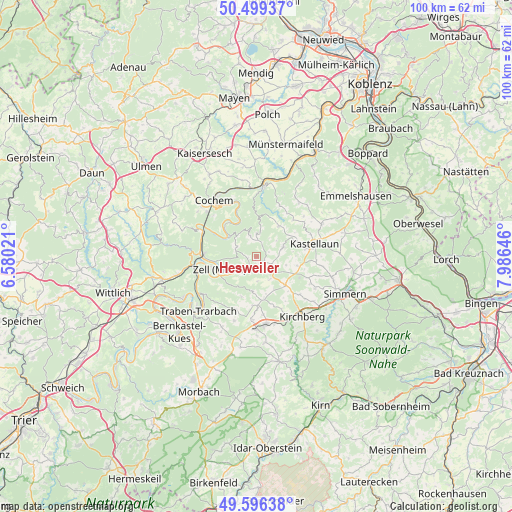
Hesweiler GPS coordinates[2]
50° 3' 0" North, 7° 16' 59.988" East
| Map corner | latitude | longitude |
|---|---|---|
| Upper-left | 50.49937°, | 6.58021° |
| Center: | 50.05°, | 7.28333° |
| Lower-right: | 49.59638°, | 7.98646° |
| Map W x H: | 100.4×100.4 km | = 62.4×62.4mi |
| max Lat: | 55.01917° ⇑62.5% North |
| Hesweiler: | 50.05° |
| min Lat: | ⇓37.5% South 47.40724° |
| min Long | Hesweiler | max Long |
| 5.92978° | 7.28333° | 14.98853° |
| W 9.7%⇐ | ⇒90.3% E |
Elevation
Elevation of Hesweiler is 369 m = 1211 ft, and this is 119.9 m = 393 ft above average elevation for this country.
| Max E: |
1256 m = 4121 ft | 28.6% |
| Hesweiler | 369 m 1211 ft | |
| Avg. | 249.1 m = 817 ft | |
Min E: |
-5 m = -16 ft | 71.4% |
See also: Germany elevation on elevation.city.
Geographical zone
Hesweiler is located in North temperate zone (between Tropic of Cancer and the Arctic Circle). Distance of this North polar circle is 1836.1 km =1140.9 mi to North.| Distance of | km | miles | from Hesweiler |
|---|---|---|---|
| North Pole | 4442 | 2760.1 | to North |
| Arctic Circle | 1836.1 | 1140.9 | to North |
| Tropic Cancer | 2959.1 | 1838.7 | to South |
| Equator | 5565 | 3457.9 | to South |


Nearby cities:
15 places around Hesweiler: (largest is in red/bold)
• Altstrimmig
5.7 km =3.5 mi,  12°
12°
• Blankenrath
1.8 km =1.1 mi,  132°
132°
• Grenderich
4 km =2.5 mi,  297°
297°
• Haserich
4 km =2.5 mi,  117°
117°
• Liesenich
3.7 km =2.3 mi,  0°
0°
• Mastershausen
5.1 km =3.2 mi,  68°
68°
• Mittelstrimmig
3.7 km =2.3 mi, 0°
• Moritzheim
1.2 km =0.7 mi,  270°
270°
• Panzweiler
3.9 km =2.4 mi,  162°
162°
• Peterswald-Löffelscheid
5.7 km =3.5 mi,  167°
167°
• Reidenhausen
2.4 km =1.5 mi,  90°
90°
• Schauren
3.9 km =2.4 mi,  197°
197°
• Sosberg
5.1 km =3.2 mi,  43°
43°
• Tellig
3 km =1.9 mi,  232°
232°
• Walhausen
1.9 km =1.2 mi,  180°
180°
Sources, notices
• [Note1] Compared only with cities in Germany existing in our database
• [Src1] Map data: © OpenStreetMap contributors (CC-BY-SA)
• [Src2] Other city data from geonames.org with taken over terms of usage.
• [Src3] Geographical zone / Annual Mean Temperature by Robert A. Rohde @ Wikipedia
