Radolfzell geodata
Radolfzell (Baden-Württemberg) is a populated place; located in Germany in Europe/Berlin (GMT+2) time zone. With population of 30,096 people, there are 464 cities with bigger population in this country. Compared to other cities in Germany, 98.3% of cities are located further ↑North; 65.8% of cities are located further →East and 75.7% of cities have lower elevation than Radolfzell. Note1
Administrative division(s):
- Level 1: Baden-Württemberg
- Level 2: Freiburg Region
- Level 3: Landkreis Konstanz
- Level 4: Radolfzell am Bodensee


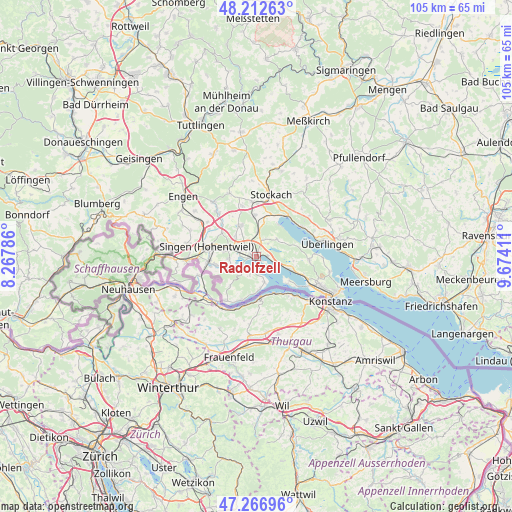
Radolfzell GPS coordinates[2]
47° 44' 30.984" North, 8° 58' 15.528" East
| Map corner | latitude | longitude |
|---|---|---|
| Upper-left | 48.21263°, | 8.26786° |
| Center: | 47.74194°, | 8.97098° |
| Lower-right: | 47.26696°, | 9.67411° |
| Map W x H: | 105.1×105.1 km | = 65.3×65.3mi |
| max Lat: | 55.01917° ⇑98.3% North |
| Radolfzell: | 47.74194° |
| min Lat: | ⇓1.7% South 47.40724° |
| min Long | Radolfzell | max Long |
| 5.92978° | 8.97098° | 14.98853° |
| W 34.2%⇐ | ⇒65.8% E |
Elevation
Elevation of Radolfzell is 403 m = 1322 ft, and this is 153.9 m = 505 ft above average elevation for this country.
| Max E: |
1256 m = 4121 ft | 24.3% |
| Radolfzell | 403 m 1322 ft | |
| Avg. | 249.1 m = 817 ft | |
Min E: |
-5 m = -16 ft | 75.7% |
See also: Germany elevation on elevation.city.
Geographical zone
Radolfzell is located in North temperate zone (between Tropic of Cancer and the Arctic Circle). Distance of this North polar circle is 2092.8 km =1300.4 mi to North.| Distance of | km | miles | from Radolfzell |
|---|---|---|---|
| North Pole | 4698.7 | 2919.6 | to North |
| Arctic Circle | 2092.8 | 1300.4 | to North |
| Tropic Cancer | 2702.5 | 1679.3 | to South |
| Equator | 5308.4 | 3298.5 | to South |


Nearby cities:
15 places around Radolfzell: (largest is in red/bold)
• Allensbach
8.1 km =5 mi,  111°
111°
• Bodman-Ludwigshafen
10.6 km =6.6 mi,  36°
36°
• Eigeltingen
14 km =8.7 mi,  337°
337°
• Gaienhofen
6.6 km =4.1 mi,  171°
171°
• Moos
3.3 km =2.1 mi,  234°
234°
• Mühlhausen-Ehingen
14.1 km =8.8 mi,  302°
302°
• Orsingen-Nenzingen
11.2 km =7 mi,  355°
355°
• Reichenau
9.1 km =5.7 mi,  130°
130°
• Rielasingen-Worblingen
9.8 km =6.1 mi,  265°
265°
• Singen
10 km =6.2 mi,  281°
281°
• Sipplingen
11.2 km =7 mi,  57°
57°
• Steißlingen
7 km =4.3 mi, 336°
• Stockach
12.5 km =7.8 mi,  13°
13°
• Volkertshausen
11.4 km =7.1 mi,  316°
316°
• Öhningen
10.9 km =6.8 mi,  215°
215°
In other languages:
- In Spanish: Radolfzell am Bodensee
- In German: Radolfzell am Bodensee
- In Russian: Радольфцелль
- In Chinese: 博登湖畔拉多夫采尔
Sources, notices
• [Note1] Compared only with cities in Germany existing in our database
• [Src1] Map data: © OpenStreetMap contributors (CC-BY-SA)
• [Src2] Other city data from geonames.org with taken over terms of usage.
• [Src3] Geographical zone / Annual Mean Temperature by Robert A. Rohde @ Wikipedia
