Oelsberg geodata
Oelsberg (Rheinland-Pfalz) is a seat of a fourth-order administrative division; located in Germany in Europe/Berlin (GMT+2) time zone. With population of 524 people, there are 9231 cities with bigger population in this country. Compared to other cities in Germany, 59.1% of cities are located further ↑North; 80.2% of cities are located further →East and 58.5% of cities have lower elevation than Oelsberg. Note1


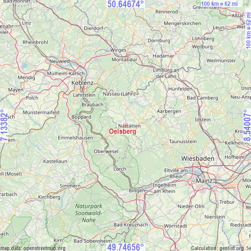
Oelsberg GPS coordinates[2]
50° 11' 55.572" North, 7° 50' 12.984" East
| Map corner | latitude | longitude |
|---|---|---|
| Upper-left | 50.64674°, | 7.13382° |
| Center: | 50.19877°, | 7.83694° |
| Lower-right: | 49.74656°, | 8.54007° |
| Map W x H: | 100.1×100.1 km | = 62.2×62.2mi |
| max Lat: | 55.01917° ⇑59.1% North |
| Oelsberg: | 50.19877° |
| min Lat: | ⇓40.9% South 47.40724° |
| min Long | Oelsberg | max Long |
| 5.92978° | 7.83694° | 14.98853° |
| W 19.8%⇐ | ⇒80.2% E |
Elevation
Elevation of Oelsberg is 281 m = 922 ft, and this is 31.9 m = 105 ft above average elevation for this country.
| Max E: |
1256 m = 4121 ft | 41.5% |
| Oelsberg | 281 m 922 ft | |
| Avg. | 249.1 m = 817 ft | |
Min E: |
-5 m = -16 ft | 58.5% |
See also: Germany elevation on elevation.city.
Geographical zone
Oelsberg is located in North temperate zone (between Tropic of Cancer and the Arctic Circle). Distance of this North polar circle is 1819.6 km =1130.6 mi to North.| Distance of | km | miles | from Oelsberg |
|---|---|---|---|
| North Pole | 4425.5 | 2749.9 | to North |
| Arctic Circle | 1819.6 | 1130.6 | to North |
| Tropic Cancer | 2975.7 | 1849 | to South |
| Equator | 5581.6 | 3468.2 | to South |


Nearby cities:
15 places around Oelsberg: (largest is in red/bold)
• Bettendorf
4.4 km =2.7 mi,  30°
30°
• Bogel
2.8 km =1.7 mi,  248°
248°
• Buch
2.1 km =1.3 mi,  86°
86°
• Diethardt
4.1 km =2.5 mi,  149°
149°
• Endlichhofen
1.4 km =0.9 mi,  284°
284°
• Hainau
4.7 km =2.9 mi,  304°
304°
• Himmighofen
5.3 km =3.3 mi,  286°
286°
• Kasdorf
3.8 km =2.4 mi, 282°
• Lautert
3.6 km =2.2 mi,  184°
184°
• Marienfels
4.9 km =3 mi,  339°
339°
• Miehlen
3 km =1.9 mi,  353°
353°
• Nastätten
1.6 km =1 mi, 89°
• Niederwallmenach
3.8 km =2.4 mi,  202°
202°
• Oberwallmenach
3.6 km =2.2 mi, 184°
• Ruppertshofen
2.2 km =1.4 mi, 275°
Sources, notices
• [Note1] Compared only with cities in Germany existing in our database
• [Src1] Map data: © OpenStreetMap contributors (CC-BY-SA)
• [Src2] Other city data from geonames.org with taken over terms of usage.
• [Src3] Geographical zone / Annual Mean Temperature by Robert A. Rohde @ Wikipedia
