Odderade geodata
Odderade (Schleswig-Holstein) is a seat of a fourth-order administrative division; located in Germany in Europe/Berlin (GMT+2) time zone. With population of 308 people, there are 10026 cities with bigger population in this country. Compared to other cities in Germany, 94.4% of cities are located further ↓South; 62.5% of cities are located further →East and 91.2% of cities have higher elevation than Odderade. Note1
Administrative division(s):
- Level 1: Schleswig-Holstein
- Level 3: Kreis Dithmarschen
- Level 4: Odderade


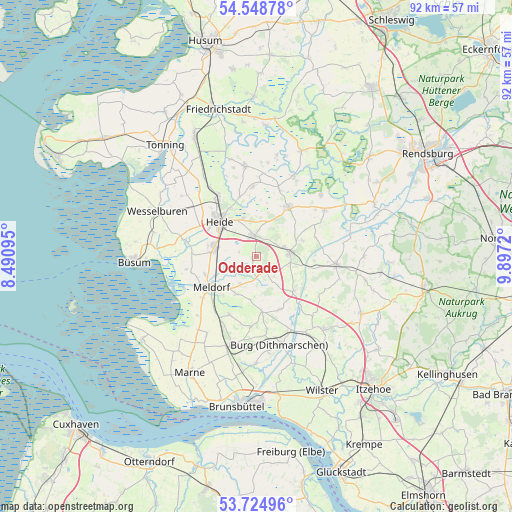
Odderade GPS coordinates[2]
54° 8' 20.112" North, 9° 11' 38.688" East
| Map corner | latitude | longitude |
|---|---|---|
| Upper-left | 54.54878°, | 8.49095° |
| Center: | 54.13892°, | 9.19408° |
| Lower-right: | 53.72496°, | 9.8972° |
| Map W x H: | 91.6×91.6 km | = 56.9×56.9mi |
| max Lat: | 55.01917° ⇑5.6% North |
| Odderade: | 54.13892° |
| min Lat: | ⇓94.4% South 47.40724° |
| min Long | Odderade | max Long |
| 5.92978° | 9.19408° | 14.98853° |
| W 37.5%⇐ | ⇒62.5% E |
Elevation
Elevation of Odderade is 18 m = 59 ft, and this is 231.1 m = 758 ft below average elevation for this country.
| Max E: |
1256 m = 4121 ft | 91.2% |
| Avg. | 249.1 m = 817 ft | |
| Odderade | 18 m = 59 ft | |
Min E: |
-5 m = -16 ft | 8.8% |
See also: Germany elevation on elevation.city.
Geographical zone
Odderade is located in North temperate zone (between Tropic of Cancer and the Arctic Circle). Distance of this North polar circle is 1381.5 km =858.4 mi to North.| Distance of | km | miles | from Odderade |
|---|---|---|---|
| North Pole | 3987.4 | 2477.7 | to North |
| Arctic Circle | 1381.5 | 858.4 | to North |
| Tropic Cancer | 3413.8 | 2121.2 | to South |
| Equator | 6019.7 | 3740.5 | to South |


Nearby cities:
15 places around Odderade: (largest is in red/bold)
• Albersdorf
5.9 km =3.7 mi,  78°
78°
• Arkebek
4.8 km =3 mi,  49°
49°
• Bargenstedt
5.2 km =3.2 mi,  213°
213°
• Bunsoh
8.7 km =5.4 mi,  70°
70°
• Gaushorn
7.3 km =4.5 mi,  20°
20°
• Hemmingstedt
8.4 km =5.2 mi,  278°
278°
• Immenstedt
8.5 km =5.3 mi, 54°
• Krumstedt
8.1 km =5 mi,  184°
184°
• Lieth
8.9 km =5.5 mi, 282°
• Nindorf
8 km =5 mi,  219°
219°
• Nordhastedt
3.2 km =2 mi,  347°
347°
• Sarzbüttel
2.6 km =1.6 mi,  195°
195°
• Schrum
6.1 km =3.8 mi,  36°
36°
• Tensbüttel-Röst
5 km =3.1 mi,  149°
149°
• Welmbüttel
7.7 km =4.8 mi,  28°
28°
Sources, notices
• [Note1] Compared only with cities in Germany existing in our database
• [Src1] Map data: © OpenStreetMap contributors (CC-BY-SA)
• [Src2] Other city data from geonames.org with taken over terms of usage.
• [Src3] Geographical zone / Annual Mean Temperature by Robert A. Rohde @ Wikipedia
