Oberweiler geodata
Oberweiler (Rheinland-Pfalz) is a seat of a fourth-order administrative division; located in Germany in Europe/Berlin (GMT+2) time zone. With population of 148 people, there are 10701 cities with bigger population in this country. Compared to other cities in Germany, 62.5% of cities are located further ↑North; 98.2% of cities are located further →East and 78.9% of cities have lower elevation than Oberweiler. Note1
Administrative division(s):
- Level 1: Rheinland-Pfalz
- Level 3: Eifelkreis Bitburg-Prüm
- Level 4: Oberweiler


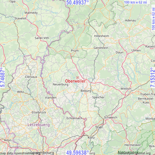
Oberweiler GPS coordinates[2]
50° 3' 0" North, 6° 27' 0" East
| Map corner | latitude | longitude |
|---|---|---|
| Upper-left | 50.49937°, | 5.74687° |
| Center: | 50.05°, | 6.45° |
| Lower-right: | 49.59638°, | 7.15312° |
| Map W x H: | 100.4×100.4 km | = 62.4×62.4mi |
| max Lat: | 55.01917° ⇑62.5% North |
| Oberweiler: | 50.05° |
| min Lat: | ⇓37.5% South 47.40724° |
| min Long | Oberweiler | max Long |
| 5.92978° | 6.45° | 14.98853° |
| W 1.8%⇐ | ⇒98.2% E |
Elevation
Elevation of Oberweiler is 426 m = 1398 ft, and this is 176.9 m = 580 ft above average elevation for this country.
| Max E: |
1256 m = 4121 ft | 21.1% |
| Oberweiler | 426 m 1398 ft | |
| Avg. | 249.1 m = 817 ft | |
Min E: |
-5 m = -16 ft | 78.9% |
See also: Germany elevation on elevation.city.
Geographical zone
Oberweiler is located in North temperate zone (between Tropic of Cancer and the Arctic Circle). Distance of this North polar circle is 1836.1 km =1140.9 mi to North.| Distance of | km | miles | from Oberweiler |
|---|---|---|---|
| North Pole | 4442 | 2760.1 | to North |
| Arctic Circle | 1836.1 | 1140.9 | to North |
| Tropic Cancer | 2959.1 | 1838.7 | to South |
| Equator | 5565 | 3457.9 | to South |


Nearby cities:
15 places around Oberweiler: (largest is in red/bold)
• Altscheid
5.1 km =3.2 mi,  223°
223°
• Bickendorf
4 km =2.5 mi,  117°
117°
• Biersdorf
3.9 km =2.4 mi,  179°
179°
• Echtershausen
4.4 km =2.7 mi,  212°
212°
• Ehlenz
1.8 km =1.1 mi,  125°
125°
• Feuerscheid
5.6 km =3.5 mi,  0°
0°
• Hamm
4.4 km =2.7 mi, 212°
• Heilenbach
2.2 km =1.4 mi,  32°
32°
• Ließem
3 km =1.9 mi, 127°
• Mauel
4 km =2.5 mi,  297°
297°
• Niederweiler
1.9 km =1.2 mi, 180°
• Plütscheid
4.4 km =2.7 mi,  327°
327°
• Schleid
3 km =1.9 mi,  52°
52°
• Seffern
4 km =2.5 mi,  62°
62°
• Sefferweich
5.1 km =3.2 mi,  68°
68°
Sources, notices
• [Note1] Compared only with cities in Germany existing in our database
• [Src1] Map data: © OpenStreetMap contributors (CC-BY-SA)
• [Src2] Other city data from geonames.org with taken over terms of usage.
• [Src3] Geographical zone / Annual Mean Temperature by Robert A. Rohde @ Wikipedia
