Norderstapel geodata
Norderstapel (Schleswig-Holstein) is a populated place; located in Germany in Europe/Berlin (GMT+2) time zone. With population of 829 people, there are 7777 cities with bigger population in this country. Compared to other cities in Germany, 96.9% of cities are located further ↓South; 61.6% of cities are located further →East and 93.9% of cities have higher elevation than Norderstapel. Note1
Administrative division(s):
- Level 1: Schleswig-Holstein
- Level 3: Kreis Schleswig-Flensburg
- Level 4: Stapel


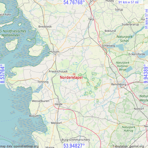
Norderstapel GPS coordinates[2]
54° 21' 36.072" North, 9° 14' 26.736" East
| Map corner | latitude | longitude |
|---|---|---|
| Upper-left | 54.76768°, | 8.53764° |
| Center: | 54.36002°, | 9.24076° |
| Lower-right: | 53.94827°, | 9.94389° |
| Map W x H: | 91.1×91.1 km | = 56.6×56.6mi |
| max Lat: | 55.01917° ⇑3.1% North |
| Norderstapel: | 54.36002° |
| min Lat: | ⇓96.9% South 47.40724° |
| min Long | Norderstapel | max Long |
| 5.92978° | 9.24076° | 14.98853° |
| W 38.4%⇐ | ⇒61.6% E |
Elevation
Elevation of Norderstapel is 11 m = 36 ft, and this is 238.1 m = 781 ft below average elevation for this country.
| Max E: |
1256 m = 4121 ft | 93.9% |
| Avg. | 249.1 m = 817 ft | |
| Norderstapel | 11 m = 36 ft | |
Min E: |
-5 m = -16 ft | 6.1% |
See also: Germany elevation on elevation.city.
Geographical zone
Norderstapel is located in North temperate zone (between Tropic of Cancer and the Arctic Circle). Distance of this North polar circle is 1356.9 km =843.1 mi to North.| Distance of | km | miles | from Norderstapel |
|---|---|---|---|
| North Pole | 3962.8 | 2462.4 | to North |
| Arctic Circle | 1356.9 | 843.1 | to North |
| Tropic Cancer | 3438.3 | 2136.5 | to South |
| Equator | 6044.3 | 3755.8 | to South |


Nearby cities:
15 places around Norderstapel: (largest is in red/bold)
• Bergenhusen
5.6 km =3.5 mi,  62°
62°
• Bergewöhrden
5.1 km =3.2 mi,  197°
197°
• Delve
6.7 km =4.2 mi,  174°
174°
• Drage
5.4 km =3.4 mi,  264°
264°
• Erfde
8.3 km =5.2 mi,  143°
143°
• Fresendelf
3.8 km =2.4 mi,  6°
6°
• Hollingstedt
7.8 km =4.8 mi,  187°
187°
• Hude
3 km =1.9 mi,  328°
328°
• Ramstedt
6.5 km =4 mi,  312°
312°
• Schwabstedt
5.4 km =3.4 mi,  319°
319°
• Seeth
4.9 km =3 mi,  278°
278°
• Süderhöft
2.6 km =1.6 mi,  349°
349°
• Süderstapel
1.8 km =1.1 mi,  230°
230°
• Wisch
8.6 km =5.3 mi, 316°
• Wohlde
6.4 km =4 mi,  36°
36°
Sources, notices
• [Note1] Compared only with cities in Germany existing in our database
• [Src1] Map data: © OpenStreetMap contributors (CC-BY-SA)
• [Src2] Other city data from geonames.org with taken over terms of usage.
• [Src3] Geographical zone / Annual Mean Temperature by Robert A. Rohde @ Wikipedia
