Drage geodata
Drage (Schleswig-Holstein) is a seat of a fourth-order administrative division; located in Germany in Europe/Berlin (GMT+2) time zone. With population of 612 people, there are 8757 cities with bigger population in this country. Compared to other cities in Germany, 96.9% of cities are located further ↓South; 63% of cities are located further →East and 97% of cities have higher elevation than Drage. Note1


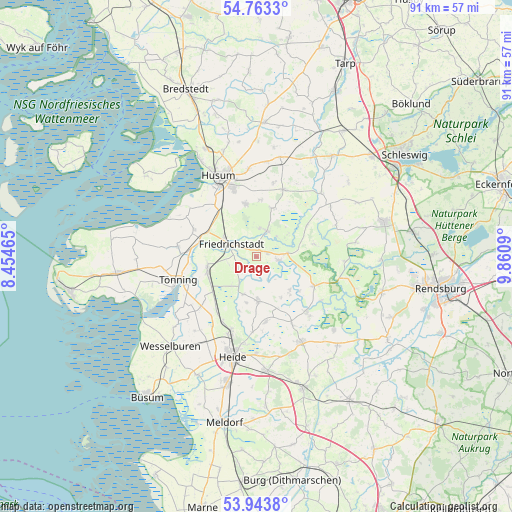
Drage GPS coordinates[2]
54° 21' 20.124" North, 9° 9' 27.972" East
| Map corner | latitude | longitude |
|---|---|---|
| Upper-left | 54.7633°, | 8.45465° |
| Center: | 54.35559°, | 9.15777° |
| Lower-right: | 53.9438°, | 9.8609° |
| Map W x H: | 91.1×91.1 km | = 56.6×56.6mi |
| max Lat: | 55.01917° ⇑3.1% North |
| Drage: | 54.35559° |
| min Lat: | ⇓96.9% South 47.40724° |
| min Long | Drage | max Long |
| 5.92978° | 9.15777° | 14.98853° |
| W 37%⇐ | ⇒63% E |
Elevation
Elevation of Drage is 4 m = 13 ft, and this is 245.1 m = 804 ft below average elevation for this country.
| Max E: |
1256 m = 4121 ft | 97% |
| Avg. | 249.1 m = 817 ft | |
| Drage | 4 m = 13 ft | |
Min E: |
-5 m = -16 ft | 3% |
See also: Germany elevation on elevation.city.
Geographical zone
Drage is located in North temperate zone (between Tropic of Cancer and the Arctic Circle). Distance of this North polar circle is 1357.4 km =843.4 mi to North.| Distance of | km | miles | from Drage |
|---|---|---|---|
| North Pole | 3963.3 | 2462.7 | to North |
| Arctic Circle | 1357.4 | 843.4 | to North |
| Tropic Cancer | 3437.9 | 2136.2 | to South |
| Equator | 6043.8 | 3755.4 | to South |


Nearby cities:
15 places around Drage: (largest is in red/bold)
• Bergewöhrden
5.8 km =3.6 mi,  138°
138°
• Fresendelf
7.2 km =4.5 mi,  53°
53°
• Friedrichstadt
5.1 km =3.2 mi,  295°
295°
• Hude
4.9 km =3 mi, 51°
• Kleve
7.1 km =4.4 mi,  197°
197°
• Koldenbüttel
6.7 km =4.2 mi, 297°
• Norderstapel
5.4 km =3.4 mi,  84°
84°
• Ramstedt
5 km =3.1 mi,  6°
6°
• Sankt Annen
5.2 km =3.2 mi,  258°
258°
• Schlichting
6.7 km =4.2 mi,  221°
221°
• Schwabstedt
5 km =3.1 mi,  21°
21°
• Seeth
1.4 km =0.9 mi,  25°
25°
• Süderhöft
5.8 km =3.6 mi,  57°
57°
• Süderstapel
4 km =2.5 mi,  99°
99°
• Wisch
6.8 km =4.2 mi,  355°
355°
Sources, notices
• [Note1] Compared only with cities in Germany existing in our database
• [Src1] Map data: © OpenStreetMap contributors (CC-BY-SA)
• [Src2] Other city data from geonames.org with taken over terms of usage.
• [Src3] Geographical zone / Annual Mean Temperature by Robert A. Rohde @ Wikipedia
