Niederwambach geodata
Niederwambach (Rheinland-Pfalz) is a seat of a fourth-order administrative division; located in Germany in Europe/Berlin (GMT+2) time zone. With population of 531 people, there are 9187 cities with bigger population in this country. Compared to other cities in Germany, 50.3% of cities are located further ↓South; 85.1% of cities are located further →East and 51% of cities have higher elevation than Niederwambach. Note1
Administrative division(s):
- Level 1: Rheinland-Pfalz
- Level 3: Landkreis Neuwied
- Level 4: Niederwambach


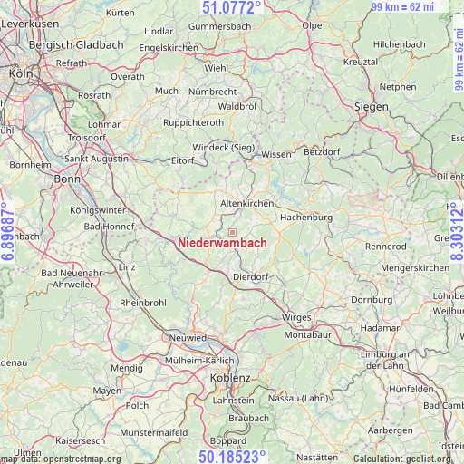
Niederwambach GPS coordinates[2]
50° 37' 59.988" North, 7° 36' 0" East
| Map corner | latitude | longitude |
|---|---|---|
| Upper-left | 51.0772°, | 6.89687° |
| Center: | 50.63333°, | 7.6° |
| Lower-right: | 50.18523°, | 8.30312° |
| Map W x H: | 99.2×99.2 km | = 61.6×61.6mi |
| max Lat: | 55.01917° ⇑49.7% North |
| Niederwambach: | 50.63333° |
| min Lat: | ⇓50.3% South 47.40724° |
| min Long | Niederwambach | max Long |
| 5.92978° | 7.6° | 14.98853° |
| W 14.9%⇐ | ⇒85.1% E |
Elevation
Elevation of Niederwambach is 218 m = 715 ft, and this is 31.1 m = 102 ft below average elevation for this country.
| Max E: |
1256 m = 4121 ft | 51% |
| Avg. | 249.1 m = 817 ft | |
| Niederwambach | 218 m = 715 ft | |
Min E: |
-5 m = -16 ft | 49% |
See also: Germany elevation on elevation.city.
Geographical zone
Niederwambach is located in North temperate zone (between Tropic of Cancer and the Arctic Circle). Distance of this North polar circle is 1771.3 km =1100.6 mi to North.| Distance of | km | miles | from Niederwambach |
|---|---|---|---|
| North Pole | 4377.2 | 2719.9 | to North |
| Arctic Circle | 1771.3 | 1100.6 | to North |
| Tropic Cancer | 3024 | 1879 | to South |
| Equator | 5629.9 | 3498.3 | to South |


Nearby cities:
15 places around Niederwambach: (largest is in red/bold)
• Berzhausen
4.4 km =2.7 mi,  327°
327°
• Döttesfeld
3.8 km =2.4 mi,  252°
252°
• Eichen
4.7 km =2.9 mi,  270°
270°
• Fluterschen
4.2 km =2.6 mi,  27°
27°
• Neitersen
4.1 km =2.5 mi,  345°
345°
• Oberdreis
4.7 km =2.9 mi,  100°
100°
• Obernau
4.4 km =2.7 mi, 327°
• Oberwambach
5.1 km =3.2 mi,  43°
43°
• Puderbach
3.9 km =2.4 mi,  162°
162°
• Ratzert
2.2 km =1.4 mi, 32°
• Reiferscheid
4 km =2.5 mi,  297°
297°
• Schöneberg
3.7 km =2.3 mi,  0°
0°
• Steimel
3 km =1.9 mi,  128°
128°
• Stürzelbach
2.2 km =1.4 mi, 32°
• Woldert
5.1 km =3.2 mi,  136°
136°
Sources, notices
• [Note1] Compared only with cities in Germany existing in our database
• [Src1] Map data: © OpenStreetMap contributors (CC-BY-SA)
• [Src2] Other city data from geonames.org with taken over terms of usage.
• [Src3] Geographical zone / Annual Mean Temperature by Robert A. Rohde @ Wikipedia
