Lonsee geodata
Lonsee (Baden-Württemberg) is a seat of a fourth-order administrative division; located in Germany in Europe/Berlin (GMT+2) time zone. With population of 4,759 people, there are 2917 cities with bigger population in this country. Compared to other cities in Germany, 88.6% of cities are located further ↑North; 51.1% of cities are located further →East and 94% of cities have lower elevation than Lonsee. Note1
Administrative division(s):
- Level 1: Baden-Württemberg
- Level 2: Tübingen Region
- Level 3: Alb-Donau-Kreis
- Level 4: Lonsee


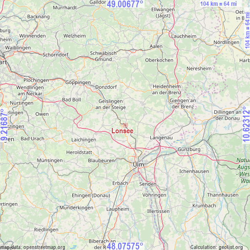
Lonsee GPS coordinates[2]
48° 32' 36.24" North, 9° 55' 11.964" East
| Map corner | latitude | longitude |
|---|---|---|
| Upper-left | 49.00677°, | 9.21687° |
| Center: | 48.5434°, | 9.91999° |
| Lower-right: | 48.07575°, | 10.62312° |
| Map W x H: | 103.5×103.5 km | = 64.3×64.3mi |
| max Lat: | 55.01917° ⇑88.6% North |
| Lonsee: | 48.5434° |
| min Lat: | ⇓11.4% South 47.40724° |
| min Long | Lonsee | max Long |
| 5.92978° | 9.91999° | 14.98853° |
| W 48.9%⇐ | ⇒51.1% E |
Elevation
Elevation of Lonsee is 575 m = 1886 ft, and this is 325.9 m = 1069 ft above average elevation for this country.
| Max E: |
1256 m = 4121 ft | 6% |
| Lonsee | 575 m 1886 ft | |
| Avg. | 249.1 m = 817 ft | |
Min E: |
-5 m = -16 ft | 94% |
See also: Germany elevation on elevation.city.
Geographical zone
Lonsee is located in North temperate zone (between Tropic of Cancer and the Arctic Circle). Distance of this North polar circle is 2003.7 km =1245 mi to North.| Distance of | km | miles | from Lonsee |
|---|---|---|---|
| North Pole | 4609.5 | 2864.2 | to North |
| Arctic Circle | 2003.7 | 1245 | to North |
| Tropic Cancer | 2791.6 | 1734.6 | to South |
| Equator | 5397.5 | 3353.8 | to South |


Nearby cities:
15 places around Lonsee: (largest is in red/bold)
• Amstetten
5.2 km =3.2 mi,  319°
319°
• Bad Überkingen
11.1 km =6.9 mi,  304°
304°
• Ballendorf
11.6 km =7.2 mi,  84°
84°
• Beimerstetten
8.1 km =5 mi,  145°
145°
• Bernstadt
9.2 km =5.7 mi,  122°
122°
• Breitingen
6.1 km =3.8 mi, 118°
• Börslingen
10.5 km =6.5 mi,  92°
92°
• Dornstadt
8.7 km =5.4 mi,  168°
168°
• Geislingen an der Steige
11.3 km =7 mi, 322°
• Gerstetten
11.5 km =7.1 mi,  39°
39°
• Holzkirch
5.7 km =3.5 mi,  103°
103°
• Neenstetten
7.3 km =4.5 mi, 87°
• Nellingen
9.5 km =5.9 mi,  269°
269°
• Weidenstetten
5.7 km =3.5 mi, 79°
• Westerstetten
3.7 km =2.3 mi,  136°
136°
Sources, notices
• [Note1] Compared only with cities in Germany existing in our database
• [Src1] Map data: © OpenStreetMap contributors (CC-BY-SA)
• [Src2] Other city data from geonames.org with taken over terms of usage.
• [Src3] Geographical zone / Annual Mean Temperature by Robert A. Rohde @ Wikipedia
