Linau geodata
Linau (Schleswig-Holstein) is a seat of a fourth-order administrative division; located in Germany in Europe/Berlin (GMT+2) time zone. With population of 1,182 people, there are 6612 cities with bigger population in this country. Compared to other cities in Germany, 87.7% of cities are located further ↓South; 58.4% of cities are located further ←West and 73.6% of cities have higher elevation than Linau. Note1
Administrative division(s):
- Level 1: Schleswig-Holstein
- Level 3: Kreis Herzogtum Lauenburg
- Level 4: Linau


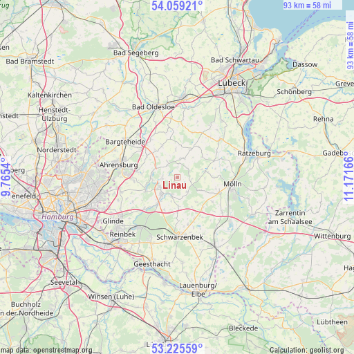
Linau GPS coordinates[2]
53° 38' 40.056" North, 10° 28' 6.708" East
| Map corner | latitude | longitude |
|---|---|---|
| Upper-left | 54.05921°, | 9.7654° |
| Center: | 53.64446°, | 10.46853° |
| Lower-right: | 53.22559°, | 11.17166° |
| Map W x H: | 92.7×92.7 km | = 57.6×57.6mi |
| max Lat: | 55.01917° ⇑12.3% North |
| Linau: | 53.64446° |
| min Lat: | ⇓87.7% South 47.40724° |
| min Long | Linau | max Long |
| 5.92978° | 10.46853° | 14.98853° |
| W 58.4%⇐ | ⇒41.6% E |
Elevation
Elevation of Linau is 69 m = 226 ft, and this is 180.1 m = 591 ft below average elevation for this country.
| Max E: |
1256 m = 4121 ft | 73.6% |
| Avg. | 249.1 m = 817 ft | |
| Linau | 69 m = 226 ft | |
Min E: |
-5 m = -16 ft | 26.4% |
See also: Germany elevation on elevation.city.
Geographical zone
Linau is located in North temperate zone (between Tropic of Cancer and the Arctic Circle). Distance of this North polar circle is 1436.5 km =892.6 mi to North.| Distance of | km | miles | from Linau |
|---|---|---|---|
| North Pole | 4042.4 | 2511.8 | to North |
| Arctic Circle | 1436.5 | 892.6 | to North |
| Tropic Cancer | 3358.8 | 2087.1 | to South |
| Equator | 5964.7 | 3706.3 | to South |


Nearby cities:
15 places around Linau: (largest is in red/bold)
• Borstorf
7.2 km =4.5 mi,  115°
115°
• Dahmker
6.9 km =4.3 mi,  190°
190°
• Grönwohld
4 km =2.5 mi,  265°
265°
• Hohenfelde
1.2 km =0.7 mi, 185°
• Koberg
3.8 km =2.4 mi,  107°
107°
• Lüchow
6.1 km =3.8 mi,  44°
44°
• Lütjensee
6.7 km =4.2 mi,  275°
275°
• Mühlenrade
5.5 km =3.4 mi,  166°
166°
• Ritzerau
6.9 km =4.3 mi,  69°
69°
• Sandesneben
4.8 km =3 mi,  25°
25°
• Schiphorst
7.1 km =4.4 mi,  356°
356°
• Schönberg
5.1 km =3.2 mi,  327°
327°
• Sirksfelde
3.2 km =2 mi, 40°
• Trittau
5.5 km =3.4 mi,  235°
235°
• Wentorf
3.4 km =2.1 mi,  5°
5°
Sources, notices
• [Note1] Compared only with cities in Germany existing in our database
• [Src1] Map data: © OpenStreetMap contributors (CC-BY-SA)
• [Src2] Other city data from geonames.org with taken over terms of usage.
• [Src3] Geographical zone / Annual Mean Temperature by Robert A. Rohde @ Wikipedia
