Kronburg geodata
Kronburg (Bavaria) is a seat of a fourth-order administrative division; located in Germany in Europe/Berlin (GMT+2) time zone. With population of 1,736 people, there are 5448 cities with bigger population in this country. Compared to other cities in Germany, 96.6% of cities are located further ↑North; 52.6% of cities are located further ←West and 97.9% of cities have lower elevation than Kronburg. Note1
Administrative division(s):
- Level 1: Bavaria
- Level 2: Swabia
- Level 3: Landkreis Unterallgäu
- Level 4: Kronburg


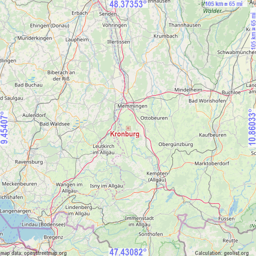
Kronburg GPS coordinates[2]
47° 54' 15.552" North, 10° 9' 25.92" East
| Map corner | latitude | longitude |
|---|---|---|
| Upper-left | 48.37353°, | 9.45407° |
| Center: | 47.90432°, | 10.1572° |
| Lower-right: | 47.43082°, | 10.86033° |
| Map W x H: | 104.8×104.8 km | = 65.1×65.1mi |
| max Lat: | 55.01917° ⇑96.6% North |
| Kronburg: | 47.90432° |
| min Lat: | ⇓3.4% South 47.40724° |
| min Long | Kronburg | max Long |
| 5.92978° | 10.1572° | 14.98853° |
| W 52.6%⇐ | ⇒47.4% E |
Elevation
Elevation of Kronburg is 702 m = 2303 ft, and this is 452.9 m = 1486 ft above average elevation for this country.
| Max E: |
1256 m = 4121 ft | 2.1% |
| Kronburg | 702 m 2303 ft | |
| Avg. | 249.1 m = 817 ft | |
Min E: |
-5 m = -16 ft | 97.9% |
See also: Germany elevation on elevation.city.
Geographical zone
Kronburg is located in North temperate zone (between Tropic of Cancer and the Arctic Circle). Distance of this North polar circle is 2074.7 km =1289.2 mi to North.| Distance of | km | miles | from Kronburg |
|---|---|---|---|
| North Pole | 4680.6 | 2908.4 | to North |
| Arctic Circle | 2074.7 | 1289.2 | to North |
| Tropic Cancer | 2720.5 | 1690.4 | to South |
| Equator | 5326.5 | 3309.7 | to South |


Nearby cities:
15 places around Kronburg: (largest is in red/bold)
• Aichstetten
6 km =3.7 mi,  257°
257°
• Aitrach
6.4 km =4 mi,  300°
300°
• Amendingen
11.1 km =6.9 mi,  8°
8°
• Benningen
8.2 km =5.1 mi,  32°
32°
• Buxheim
10.8 km =6.7 mi,  350°
350°
• Böhen
10.9 km =6.8 mi,  102°
102°
• Dickenreishausen
5.5 km =3.4 mi, 9°
• Hawangen
10.7 km =6.6 mi,  49°
49°
• Lachen
7.7 km =4.8 mi, 52°
• Lautrach
3 km =1.9 mi, 256°
• Legau
5.7 km =3.5 mi,  200°
200°
• Memmingen
9.1 km =5.7 mi, 13°
• Memmingerberg
10.5 km =6.5 mi, 27°
• Wolfertschwenden
8.3 km =5.2 mi, 98°
• Woringen
3.5 km =2.2 mi,  66°
66°
Sources, notices
• [Note1] Compared only with cities in Germany existing in our database
• [Src1] Map data: © OpenStreetMap contributors (CC-BY-SA)
• [Src2] Other city data from geonames.org with taken over terms of usage.
• [Src3] Geographical zone / Annual Mean Temperature by Robert A. Rohde @ Wikipedia
