Klosterlechfeld geodata
Klosterlechfeld (Bavaria) is a seat of a fourth-order administrative division; located in Germany in Europe/Berlin (GMT+2) time zone. With population of 2,351 people, there are 4603 cities with bigger population in this country. Compared to other cities in Germany, 93.3% of cities are located further ↑North; 64.5% of cities are located further ←West and 93.2% of cities have lower elevation than Klosterlechfeld. Note1
Administrative division(s):
- Level 1: Bavaria
- Level 2: Swabia
- Level 3: Landkreis Augsburg
- Level 4: Klosterlechfeld


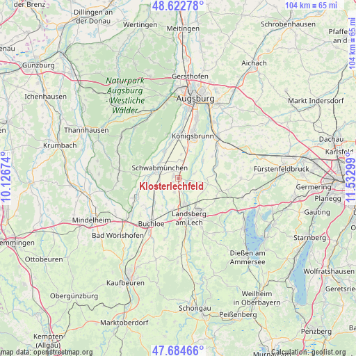
Klosterlechfeld GPS coordinates[2]
48° 9' 21.096" North, 10° 49' 47.496" East
| Map corner | latitude | longitude |
|---|---|---|
| Upper-left | 48.62278°, | 10.12674° |
| Center: | 48.15586°, | 10.82986° |
| Lower-right: | 47.68466°, | 11.53299° |
| Map W x H: | 104.3×104.3 km | = 64.8×64.8mi |
| max Lat: | 55.01917° ⇑93.3% North |
| Klosterlechfeld: | 48.15586° |
| min Lat: | ⇓6.7% South 47.40724° |
| min Long | Klosterlechfeld | max Long |
| 5.92978° | 10.82986° | 14.98853° |
| W 64.5%⇐ | ⇒35.5% E |
Elevation
Elevation of Klosterlechfeld is 561 m = 1841 ft, and this is 311.9 m = 1023 ft above average elevation for this country.
| Max E: |
1256 m = 4121 ft | 6.8% |
| Klosterlechfeld | 561 m 1841 ft | |
| Avg. | 249.1 m = 817 ft | |
Min E: |
-5 m = -16 ft | 93.2% |
See also: Germany elevation on elevation.city.
Geographical zone
Klosterlechfeld is located in North temperate zone (between Tropic of Cancer and the Arctic Circle). Distance of this North polar circle is 2046.7 km =1271.8 mi to North.| Distance of | km | miles | from Klosterlechfeld |
|---|---|---|---|
| North Pole | 4652.6 | 2891 | to North |
| Arctic Circle | 2046.7 | 1271.8 | to North |
| Tropic Cancer | 2748.5 | 1707.8 | to South |
| Equator | 5354.4 | 3327.1 | to South |


Nearby cities:
15 places around Klosterlechfeld: (largest is in red/bold)
• Graben
3.5 km =2.2 mi,  350°
350°
• Großaitingen
8.8 km =5.5 mi,  334°
334°
• Hiltenfingen
8.4 km =5.2 mi,  273°
273°
• Hurlach
4.4 km =2.7 mi,  198°
198°
• Kaufering
8.1 km =5 mi,  153°
153°
• Kleinaitingen
7.6 km =4.7 mi,  22°
22°
• Lamerdingen
9.8 km =6.1 mi,  223°
223°
• Langerringen
5.4 km =3.4 mi,  258°
258°
• Obermeitingen
2 km =1.2 mi,  240°
240°
• Oberottmarshausen
9.3 km =5.8 mi,  12°
12°
• Prittriching
8.8 km =5.5 mi,  55°
55°
• Scheuring
5.1 km =3.2 mi,  74°
74°
• Schwabmünchen
6 km =3.7 mi,  295°
295°
• Untermeitingen
1.8 km =1.1 mi,  287°
287°
• Weil
8.1 km =5 mi,  122°
122°
Sources, notices
• [Note1] Compared only with cities in Germany existing in our database
• [Src1] Map data: © OpenStreetMap contributors (CC-BY-SA)
• [Src2] Other city data from geonames.org with taken over terms of usage.
• [Src3] Geographical zone / Annual Mean Temperature by Robert A. Rohde @ Wikipedia
