Kleinobringen geodata
Kleinobringen (Thuringia) is a seat of a fourth-order administrative division; located in Germany in Europe/Berlin (GMT+2) time zone. With population of 288 people, there are 10102 cities with bigger population in this country. Compared to other cities in Germany, 58.6% of cities are located further ↓South; 71.5% of cities are located further ←West and 59.1% of cities have lower elevation than Kleinobringen. Note1


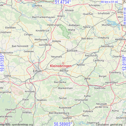
Kleinobringen GPS coordinates[2]
51° 1' 59.988" North, 11° 19' 0.012" East
| Map corner | latitude | longitude |
|---|---|---|
| Upper-left | 51.4734°, | 10.61355° |
| Center: | 51.03333°, | 11.31667° |
| Lower-right: | 50.58905°, | 12.0198° |
| Map W x H: | 98.3×98.3 km | = 61.1×61.1mi |
| max Lat: | 55.01917° ⇑41.4% North |
| Kleinobringen: | 51.03333° |
| min Lat: | ⇓58.6% South 47.40724° |
| min Long | Kleinobringen | max Long |
| 5.92978° | 11.31667° | 14.98853° |
| W 71.5%⇐ | ⇒28.5% E |
Elevation
Elevation of Kleinobringen is 284 m = 932 ft, and this is 34.9 m = 115 ft above average elevation for this country.
| Max E: |
1256 m = 4121 ft | 40.9% |
| Kleinobringen | 284 m 932 ft | |
| Avg. | 249.1 m = 817 ft | |
Min E: |
-5 m = -16 ft | 59.1% |
See also: Germany elevation on elevation.city.
Geographical zone
Kleinobringen is located in North temperate zone (between Tropic of Cancer and the Arctic Circle). Distance of this North polar circle is 1726.8 km =1073 mi to North.| Distance of | km | miles | from Kleinobringen |
|---|---|---|---|
| North Pole | 4332.7 | 2692.2 | to North |
| Arctic Circle | 1726.8 | 1073 | to North |
| Tropic Cancer | 3068.5 | 1906.7 | to South |
| Equator | 5674.4 | 3525.9 | to South |


Nearby cities:
15 places around Kleinobringen: (largest is in red/bold)
• Berlstedt
6 km =3.7 mi,  301°
301°
• Buttelstedt
5.2 km =3.2 mi,  21°
21°
• Ettersburg
2.6 km =1.6 mi,  271°
271°
• Großobringen
1.2 km =0.7 mi,  90°
90°
• Heichelheim
1.9 km =1.2 mi,  0°
0°
• Krautheim
5.7 km =3.5 mi,  348°
348°
• Kromsdorf
5.1 km =3.2 mi,  136°
136°
• Leutenthal
4 km =2.5 mi,  62°
62°
• Liebstedt
6.1 km =3.8 mi,  72°
72°
• Ramsla
3 km =1.9 mi,  308°
308°
• Rohrbach
6.9 km =4.3 mi, 57°
• Sachsenhausen
4 km =2.5 mi, 62°
• Schwerstedt
4.4 km =2.7 mi,  327°
327°
• Weimar
6 km =3.7 mi,  171°
171°
• Wohlsborn
3.5 km =2.2 mi, 90°
Sources, notices
• [Note1] Compared only with cities in Germany existing in our database
• [Src1] Map data: © OpenStreetMap contributors (CC-BY-SA)
• [Src2] Other city data from geonames.org with taken over terms of usage.
• [Src3] Geographical zone / Annual Mean Temperature by Robert A. Rohde @ Wikipedia
