Kalenborn geodata
Kalenborn (Rheinland-Pfalz) is a seat of a fourth-order administrative division; located in Germany in Europe/Berlin (GMT+2) time zone. With population of 245 people, there are 10278 cities with bigger population in this country. Compared to other cities in Germany, 57.5% of cities are located further ↑North; 92.5% of cities are located further →East and 88.7% of cities have lower elevation than Kalenborn. Note1
Administrative division(s):
- Level 1: Rheinland-Pfalz
- Level 3: Landkreis Cochem-Zell
- Level 4: Kalenborn


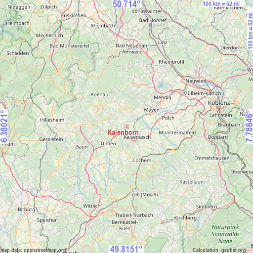
Kalenborn GPS coordinates[2]
50° 16' 0.012" North, 7° 4' 59.988" East
| Map corner | latitude | longitude |
|---|---|---|
| Upper-left | 50.714°, | 6.38021° |
| Center: | 50.26667°, | 7.08333° |
| Lower-right: | 49.8151°, | 7.78646° |
| Map W x H: | 99.9×99.9 km | = 62.1×62.1mi |
| max Lat: | 55.01917° ⇑57.5% North |
| Kalenborn: | 50.26667° |
| min Lat: | ⇓42.5% South 47.40724° |
| min Long | Kalenborn | max Long |
| 5.92978° | 7.08333° | 14.98853° |
| W 7.5%⇐ | ⇒92.5% E |
Elevation
Elevation of Kalenborn is 501 m = 1644 ft, and this is 251.9 m = 826 ft above average elevation for this country.
| Max E: |
1256 m = 4121 ft | 11.3% |
| Kalenborn | 501 m 1644 ft | |
| Avg. | 249.1 m = 817 ft | |
Min E: |
-5 m = -16 ft | 88.7% |
See also: Germany elevation on elevation.city.
Geographical zone
Kalenborn is located in North temperate zone (between Tropic of Cancer and the Arctic Circle). Distance of this North polar circle is 1812 km =1125.9 mi to North.| Distance of | km | miles | from Kalenborn |
|---|---|---|---|
| North Pole | 4417.9 | 2745.2 | to North |
| Arctic Circle | 1812 | 1125.9 | to North |
| Tropic Cancer | 2983.2 | 1853.7 | to South |
| Equator | 5589.1 | 3472.9 | to South |


Nearby cities:
15 places around Kalenborn: (largest is in red/bold)
• Anschau
3.9 km =2.4 mi,  17°
17°
• Arbach
3 km =1.9 mi,  308°
308°
• Bermel
1.9 km =1.2 mi,  0°
0°
• Ditscheid
3.9 km =2.4 mi,  342°
342°
• Eppenberg
2.2 km =1.4 mi,  212°
212°
• Hauroth
2.2 km =1.4 mi,  147°
147°
• Kaperich
4 km =2.5 mi,  242°
242°
• Laubach
3.8 km =2.4 mi,  190°
190°
• Lirstal
4 km =2.5 mi, 242°
• Masburg
3.8 km =2.4 mi,  140°
140°
• Münk
5.1 km =3.2 mi,  316°
316°
• Oberelz
2.4 km =1.5 mi,  270°
270°
• Retterath
4.7 km =2.9 mi, 270°
• Uersfeld
5.1 km =3.2 mi,  248°
248°
• Urmersbach
4 km =2.5 mi,  117°
117°
Sources, notices
• [Note1] Compared only with cities in Germany existing in our database
• [Src1] Map data: © OpenStreetMap contributors (CC-BY-SA)
• [Src2] Other city data from geonames.org with taken over terms of usage.
• [Src3] Geographical zone / Annual Mean Temperature by Robert A. Rohde @ Wikipedia
