Kahla geodata
Kahla (Thuringia) is a populated place; located in Germany in Europe/Berlin (GMT+2) time zone. With population of 7,422 people, there are 2088 cities with bigger population in this country. Compared to other cities in Germany, 54.3% of cities are located further ↓South; 75.6% of cities are located further ←West and 56.1% of cities have higher elevation than Kahla. Note1


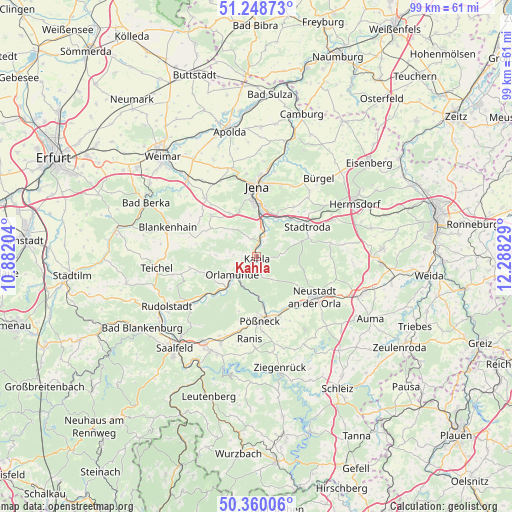
Kahla GPS coordinates[2]
50° 48' 23.436" North, 11° 35' 6.576" East
| Map corner | latitude | longitude |
|---|---|---|
| Upper-left | 51.24873°, | 10.88204° |
| Center: | 50.80651°, | 11.58516° |
| Lower-right: | 50.36006°, | 12.28829° |
| Map W x H: | 98.8×98.8 km | = 61.4×61.4mi |
| max Lat: | 55.01917° ⇑45.7% North |
| Kahla: | 50.80651° |
| min Lat: | ⇓54.3% South 47.40724° |
| min Long | Kahla | max Long |
| 5.92978° | 11.58516° | 14.98853° |
| W 75.6%⇐ | ⇒24.4% E |
Elevation
Elevation of Kahla is 181 m = 594 ft, and this is 68.1 m = 223 ft below average elevation for this country.
| Max E: |
1256 m = 4121 ft | 56.1% |
| Avg. | 249.1 m = 817 ft | |
| Kahla | 181 m = 594 ft | |
Min E: |
-5 m = -16 ft | 43.9% |
See also: Germany elevation on elevation.city.
Geographical zone
Kahla is located in North temperate zone (between Tropic of Cancer and the Arctic Circle). Distance of this North polar circle is 1752 km =1088.6 mi to North.| Distance of | km | miles | from Kahla |
|---|---|---|---|
| North Pole | 4357.9 | 2707.9 | to North |
| Arctic Circle | 1752 | 1088.6 | to North |
| Tropic Cancer | 3043.2 | 1891 | to South |
| Equator | 5649.2 | 3510.2 | to South |


Nearby cities:
15 places around Kahla: (largest is in red/bold)
• Altenberga
4.7 km =2.9 mi,  309°
309°
• Bibra
2.7 km =1.7 mi,  263°
263°
• Eichenberg
3.7 km =2.3 mi, 258°
• Freienorla
5.1 km =3.2 mi,  209°
209°
• Großeutersdorf
2.9 km =1.8 mi, 206°
• Großpürschütz
1.5 km =0.9 mi,  42°
42°
• Gumperda
4.3 km =2.7 mi,  274°
274°
• Hummelshain
5.6 km =3.5 mi,  142°
142°
• Kleineutersdorf
2.6 km =1.6 mi,  182°
182°
• Lindig
2.8 km =1.7 mi,  157°
157°
• Oberbodnitz
5.8 km =3.6 mi,  97°
97°
• Rothenstein
4.9 km =3 mi,  12°
12°
• Schöps
3.2 km =2 mi,  19°
19°
• Seitenroda
2.3 km =1.4 mi,  108°
108°
• Unterbodnitz
4.7 km =2.9 mi,  76°
76°
Sources, notices
• [Note1] Compared only with cities in Germany existing in our database
• [Src1] Map data: © OpenStreetMap contributors (CC-BY-SA)
• [Src2] Other city data from geonames.org with taken over terms of usage.
• [Src3] Geographical zone / Annual Mean Temperature by Robert A. Rohde @ Wikipedia
