Ingendorf geodata
Ingendorf (Rheinland-Pfalz) is a seat of a fourth-order administrative division; located in Germany in Europe/Berlin (GMT+2) time zone. With population of 245 people, there are 10278 cities with bigger population in this country. Compared to other cities in Germany, 65.6% of cities are located further ↑North; 98.2% of cities are located further →East and 60.4% of cities have lower elevation than Ingendorf. Note1
Administrative division(s):
- Level 1: Rheinland-Pfalz
- Level 3: Eifelkreis Bitburg-Prüm
- Level 4: Ingendorf


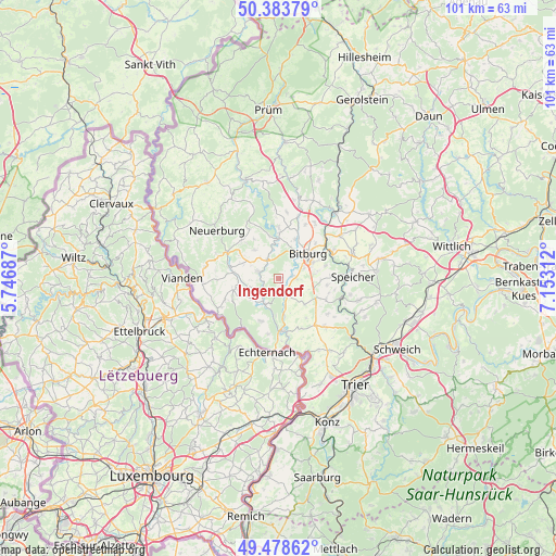
Ingendorf GPS coordinates[2]
49° 55' 59.988" North, 6° 27' 0" East
| Map corner | latitude | longitude |
|---|---|---|
| Upper-left | 50.38379°, | 5.74687° |
| Center: | 49.93333°, | 6.45° |
| Lower-right: | 49.47862°, | 7.15312° |
| Map W x H: | 100.6×100.6 km | = 62.5×62.5mi |
| max Lat: | 55.01917° ⇑65.6% North |
| Ingendorf: | 49.93333° |
| min Lat: | ⇓34.4% South 47.40724° |
| min Long | Ingendorf | max Long |
| 5.92978° | 6.45° | 14.98853° |
| W 1.8%⇐ | ⇒98.2% E |
Elevation
Elevation of Ingendorf is 292 m = 958 ft, and this is 42.9 m = 141 ft above average elevation for this country.
| Max E: |
1256 m = 4121 ft | 39.6% |
| Ingendorf | 292 m 958 ft | |
| Avg. | 249.1 m = 817 ft | |
Min E: |
-5 m = -16 ft | 60.4% |
See also: Germany elevation on elevation.city.
Geographical zone
Ingendorf is located in North temperate zone (between Tropic of Cancer and the Arctic Circle). Distance of this North polar circle is 1849.1 km =1149 mi to North.| Distance of | km | miles | from Ingendorf |
|---|---|---|---|
| North Pole | 4455 | 2768.2 | to North |
| Arctic Circle | 1849.1 | 1149 | to North |
| Tropic Cancer | 2946.1 | 1830.6 | to South |
| Equator | 5552.1 | 3449.9 | to South |


Nearby cities:
15 places around Ingendorf: (largest is in red/bold)
• Alsdorf
5.2 km =3.2 mi,  165°
165°
• Bettingen
3.6 km =2.2 mi,  285°
285°
• Birtlingen
3 km =1.9 mi,  52°
52°
• Dockendorf
2.2 km =1.4 mi,  147°
147°
• Holsthum
5.2 km =3.2 mi,  211°
211°
• Messerich
2.4 km =1.5 mi,  90°
90°
• Mülbach
5.1 km =3.2 mi,  320°
320°
• Niederstedem
3.6 km =2.2 mi, 90°
• Oberstedem
4.8 km =3 mi, 90°
• Oberweis
4.4 km =2.7 mi,  327°
327°
• Olsdorf
5.3 km =3.3 mi, 294°
• Peffingen
5.2 km =3.2 mi,  224°
224°
• Stockem
4.8 km =3 mi,  270°
270°
• Wettlingen
3.6 km =2.2 mi, 270°
• Wolsfeld
3.1 km =1.9 mi,  158°
158°
Sources, notices
• [Note1] Compared only with cities in Germany existing in our database
• [Src1] Map data: © OpenStreetMap contributors (CC-BY-SA)
• [Src2] Other city data from geonames.org with taken over terms of usage.
• [Src3] Geographical zone / Annual Mean Temperature by Robert A. Rohde @ Wikipedia
