Bettingen geodata
Bettingen (Rheinland-Pfalz) is a seat of a fourth-order administrative division; located in Germany in Europe/Berlin (GMT+2) time zone. With population of 1,013 people, there are 7135 cities with bigger population in this country. Compared to other cities in Germany, 65.3% of cities are located further ↑North; 98.5% of cities are located further →East and 51.8% of cities have higher elevation than Bettingen. Note1
Administrative division(s):
- Level 1: Rheinland-Pfalz
- Level 3: Eifelkreis Bitburg-Prüm
- Level 4: Bettingen


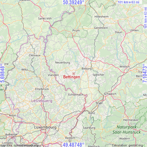
Bettingen GPS coordinates[2]
49° 56' 31.596" North, 6° 24' 5.76" East
| Map corner | latitude | longitude |
|---|---|---|
| Upper-left | 50.39249°, | 5.69848° |
| Center: | 49.94211°, | 6.4016° |
| Lower-right: | 49.48748°, | 7.10473° |
| Map W x H: | 100.6×100.6 km | = 62.5×62.5mi |
| max Lat: | 55.01917° ⇑65.3% North |
| Bettingen: | 49.94211° |
| min Lat: | ⇓34.7% South 47.40724° |
| min Long | Bettingen | max Long |
| 5.92978° | 6.4016° | 14.98853° |
| W 1.5%⇐ | ⇒98.5% E |
Elevation
Elevation of Bettingen is 213 m = 699 ft, and this is 36.1 m = 118 ft below average elevation for this country.
| Max E: |
1256 m = 4121 ft | 51.8% |
| Avg. | 249.1 m = 817 ft | |
| Bettingen | 213 m = 699 ft | |
Min E: |
-5 m = -16 ft | 48.2% |
See also: Germany elevation on elevation.city.
Geographical zone
Bettingen is located in North temperate zone (between Tropic of Cancer and the Arctic Circle). Distance of this North polar circle is 1848.1 km =1148.4 mi to North.| Distance of | km | miles | from Bettingen |
|---|---|---|---|
| North Pole | 4454 | 2767.6 | to North |
| Arctic Circle | 1848.1 | 1148.4 | to North |
| Tropic Cancer | 2947.1 | 1831.2 | to South |
| Equator | 5553 | 3450.5 | to South |


Nearby cities:
15 places around Bettingen: (largest is in red/bold)
• Baustert
4.1 km =2.5 mi,  348°
348°
• Brimingen
4.1 km =2.5 mi,  318°
318°
• Burg
4.6 km =2.9 mi,  306°
306°
• Enzen
3.8 km =2.4 mi,  221°
221°
• Feilsdorf
4.7 km =2.9 mi,  13°
13°
• Halsdorf
2.7 km =1.7 mi,  248°
248°
• Hisel
3.1 km =1.9 mi, 319°
• Ingendorf
3.6 km =2.2 mi,  105°
105°
• Mülbach
3 km =1.9 mi,  4°
4°
• Niehl
3.7 km =2.3 mi,  297°
297°
• Oberweis
2.9 km =1.8 mi,  21°
21°
• Olsdorf
1.9 km =1.2 mi, 312°
• Peffingen
4.7 km =2.9 mi,  181°
181°
• Stockem
1.6 km =1 mi,  233°
233°
• Wettlingen
1 km =0.6 mi,  186°
186°
Sources, notices
• [Note1] Compared only with cities in Germany existing in our database
• [Src1] Map data: © OpenStreetMap contributors (CC-BY-SA)
• [Src2] Other city data from geonames.org with taken over terms of usage.
• [Src3] Geographical zone / Annual Mean Temperature by Robert A. Rohde @ Wikipedia
