Hörup geodata
Hörup (Schleswig-Holstein) is a seat of a fourth-order administrative division; located in Germany in Europe/Berlin (GMT+2) time zone. With population of 638 people, there are 8609 cities with bigger population in this country. Compared to other cities in Germany, 99.4% of cities are located further ↓South; 63.9% of cities are located further →East and 95.2% of cities have higher elevation than Hörup. Note1
Administrative division(s):
- Level 1: Schleswig-Holstein
- Level 3: Kreis Schleswig-Flensburg
- Level 4: Hörup


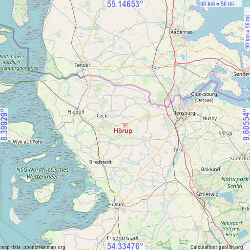
Hörup GPS coordinates[2]
54° 44' 33.648" North, 9° 6' 8.712" East
| Map corner | latitude | longitude |
|---|---|---|
| Upper-left | 55.14653°, | 8.39929° |
| Center: | 54.74268°, | 9.10242° |
| Lower-right: | 54.33476°, | 9.80554° |
| Map W x H: | 90.3×90.3 km | = 56.1×56.1mi |
| max Lat: | 55.01917° ⇑0.6% North |
| Hörup: | 54.74268° |
| min Lat: | ⇓99.4% South 47.40724° |
| min Long | Hörup | max Long |
| 5.92978° | 9.10242° | 14.98853° |
| W 36.1%⇐ | ⇒63.9% E |
Elevation
Elevation of Hörup is 8 m = 26 ft, and this is 241.1 m = 791 ft below average elevation for this country.
| Max E: |
1256 m = 4121 ft | 95.2% |
| Avg. | 249.1 m = 817 ft | |
| Hörup | 8 m = 26 ft | |
Min E: |
-5 m = -16 ft | 4.8% |
See also: Germany elevation on elevation.city.
Geographical zone
Hörup is located in North temperate zone (between Tropic of Cancer and the Arctic Circle). Distance of this North polar circle is 1314.4 km =816.7 mi to North.| Distance of | km | miles | from Hörup |
|---|---|---|---|
| North Pole | 3920.2 | 2435.9 | to North |
| Arctic Circle | 1314.4 | 816.7 | to North |
| Tropic Cancer | 3480.9 | 2162.9 | to South |
| Equator | 6086.8 | 3782.2 | to South |


Nearby cities:
15 places around Hörup: (largest is in red/bold)
• Achtrup
7.1 km =4.4 mi,  318°
318°
• Goldebek
7.3 km =4.5 mi,  155°
155°
• Goldelund
6.6 km =4.1 mi,  181°
181°
• Holt
8.8 km =5.5 mi,  20°
20°
• Leck
8.1 km =5 mi,  289°
289°
• Lindewitt
7.9 km =4.9 mi,  127°
127°
• Lütjenholm
8.6 km =5.3 mi,  219°
219°
• Medelby
9 km =5.6 mi,  30°
30°
• Meyn
7.9 km =4.9 mi,  77°
77°
• Nordhackstedt
4.3 km =2.7 mi,  104°
104°
• Osterby
9.7 km =6 mi,  48°
48°
• Schafflund
5.5 km =3.4 mi,  71°
71°
• Sprakebüll
4.7 km =2.9 mi,  344°
344°
• Stadum
3.5 km =2.2 mi,  252°
252°
• Wallsbüll
9.4 km =5.8 mi, 66°
Sources, notices
• [Note1] Compared only with cities in Germany existing in our database
• [Src1] Map data: © OpenStreetMap contributors (CC-BY-SA)
• [Src2] Other city data from geonames.org with taken over terms of usage.
• [Src3] Geographical zone / Annual Mean Temperature by Robert A. Rohde @ Wikipedia
