Hamdorf geodata
Hamdorf (Schleswig-Holstein) is a seat of a fourth-order administrative division; located in Germany in Europe/Berlin (GMT+2) time zone. With population of 1,316 people, there are 6262 cities with bigger population in this country. Compared to other cities in Germany, 95.5% of cities are located further ↓South; 57.4% of cities are located further →East and 92% of cities have higher elevation than Hamdorf. Note1
Administrative division(s):
- Level 1: Schleswig-Holstein
- Level 3: Kreis Rendsburg-Eckernförde
- Level 4: Hamdorf


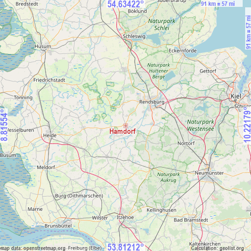
Hamdorf GPS coordinates[2]
54° 13' 30.792" North, 9° 31' 7.176" East
| Map corner | latitude | longitude |
|---|---|---|
| Upper-left | 54.63422°, | 8.81554° |
| Center: | 54.22522°, | 9.51866° |
| Lower-right: | 53.81212°, | 10.22179° |
| Map W x H: | 91.4×91.4 km | = 56.8×56.8mi |
| max Lat: | 55.01917° ⇑4.5% North |
| Hamdorf: | 54.22522° |
| min Lat: | ⇓95.5% South 47.40724° |
| min Long | Hamdorf | max Long |
| 5.92978° | 9.51866° | 14.98853° |
| W 42.6%⇐ | ⇒57.4% E |
Elevation
Elevation of Hamdorf is 16 m = 52 ft, and this is 233.1 m = 765 ft below average elevation for this country.
| Max E: |
1256 m = 4121 ft | 92% |
| Avg. | 249.1 m = 817 ft | |
| Hamdorf | 16 m = 52 ft | |
Min E: |
-5 m = -16 ft | 8% |
See also: Germany elevation on elevation.city.
Geographical zone
Hamdorf is located in North temperate zone (between Tropic of Cancer and the Arctic Circle). Distance of this North polar circle is 1371.9 km =852.5 mi to North.| Distance of | km | miles | from Hamdorf |
|---|---|---|---|
| North Pole | 3977.8 | 2471.7 | to North |
| Arctic Circle | 1371.9 | 852.5 | to North |
| Tropic Cancer | 3423.4 | 2127.2 | to South |
| Equator | 6029.3 | 3746.4 | to South |


Nearby cities:
15 places around Hamdorf: (largest is in red/bold)
• Bargstall
5.7 km =3.5 mi,  323°
323°
• Breiholz
2.2 km =1.4 mi,  171°
171°
• Elsdorf-Westermühlen
4.6 km =2.9 mi,  358°
358°
• Embühren
7.8 km =4.8 mi,  147°
147°
• Friedrichsgraben
8.1 km =5 mi,  304°
304°
• Haale
5.1 km =3.2 mi,  156°
156°
• Hamweddel
7.9 km =4.9 mi,  126°
126°
• Hohn
8.4 km =5.2 mi,  351°
351°
• Hörsten
4.3 km =2.7 mi,  77°
77°
• Nübbel
7.9 km =4.9 mi,  54°
54°
• Oldenbüttel
7.9 km =4.9 mi,  214°
214°
• Prinzenmoor
4.6 km =2.9 mi,  257°
257°
• Schülp
8.2 km =5.1 mi,  62°
62°
• Sophienhamm
7.3 km =4.5 mi,  332°
332°
• Tackesdorf
5.2 km =3.2 mi, 206°
Sources, notices
• [Note1] Compared only with cities in Germany existing in our database
• [Src1] Map data: © OpenStreetMap contributors (CC-BY-SA)
• [Src2] Other city data from geonames.org with taken over terms of usage.
• [Src3] Geographical zone / Annual Mean Temperature by Robert A. Rohde @ Wikipedia
