Grenzach-Wyhlen geodata
Grenzach-Wyhlen (Baden-Württemberg) is a seat of a fourth-order administrative division; located in Germany in Europe/Berlin (GMT+2) time zone. With population of 13,776 people, there are 1160 cities with bigger population in this country. Compared to other cities in Germany, 99.9% of cities are located further ↑North; 83.4% of cities are located further →East and 56.5% of cities have lower elevation than Grenzach-Wyhlen. Note1
Administrative division(s):
- Level 1: Baden-Württemberg
- Level 2: Freiburg Region
- Level 3: Landkreis Lörrach
- Level 4: Grenzach-Wyhlen


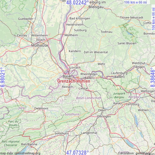
Grenzach-Wyhlen GPS coordinates[2]
47° 33' 0" North, 7° 40' 59.988" East
| Map corner | latitude | longitude |
|---|---|---|
| Upper-left | 48.02242°, | 6.98021° |
| Center: | 47.55°, | 7.68333° |
| Lower-right: | 47.07328°, | 8.38646° |
| Map W x H: | 105.5×105.5 km | = 65.6×65.6mi |
| max Lat: | 55.01917° ⇑99.9% North |
| Grenzach-Wyhlen: | 47.55° |
| min Lat: | ⇓0.1% South 47.40724° |
| min Long | Grenzach-Wyhlen | max Long |
| 5.92978° | 7.68333° | 14.98853° |
| W 16.6%⇐ | ⇒83.4% E |
Elevation
Elevation of Grenzach-Wyhlen is 269 m = 883 ft, and this is 19.9 m = 65 ft above average elevation for this country.
| Max E: |
1256 m = 4121 ft | 43.5% |
| Grenzach-Wyhlen | 269 m 883 ft | |
| Avg. | 249.1 m = 817 ft | |
Min E: |
-5 m = -16 ft | 56.5% |
See also: Germany elevation on elevation.city.
Geographical zone
Grenzach-Wyhlen is located in North temperate zone (between Tropic of Cancer and the Arctic Circle). Distance of this North polar circle is 2114.1 km =1313.6 mi to North.| Distance of | km | miles | from Grenzach-Wyhlen |
|---|---|---|---|
| North Pole | 4720 | 2932.9 | to North |
| Arctic Circle | 2114.1 | 1313.6 | to North |
| Tropic Cancer | 2681.1 | 1666 | to South |
| Equator | 5287.1 | 3285.3 | to South |


Nearby cities:
15 places around Grenzach-Wyhlen: (largest is in red/bold)
• Binzen
10.5 km =6.5 mi,  331°
331°
• Efringen-Kirchen
14.1 km =8.8 mi,  321°
321°
• Eimeldingen
11.2 km =7 mi, 326°
• Fischingen
12.8 km =8 mi, 330°
• Inzlingen
4.3 km =2.7 mi,  7°
7°
• Lörrach
7.4 km =4.6 mi,  348°
348°
• Maulburg
13 km =8.1 mi,  34°
34°
• Rheinfelden
7.9 km =4.9 mi,  81°
81°
• Rümmingen
10.6 km =6.6 mi,  342°
342°
• Schallbach
11.7 km =7.3 mi, 341°
• Schopfheim
15.3 km =9.5 mi,  42°
42°
• Schwörstadt
15.4 km =9.6 mi,  71°
71°
• Steinen
11.3 km =7 mi,  21°
21°
• Weil am Rhein
6.7 km =4.2 mi, 315°
• Wittlingen
12 km =7.5 mi, 348°
Sources, notices
• [Note1] Compared only with cities in Germany existing in our database
• [Src1] Map data: © OpenStreetMap contributors (CC-BY-SA)
• [Src2] Other city data from geonames.org with taken over terms of usage.
• [Src3] Geographical zone / Annual Mean Temperature by Robert A. Rohde @ Wikipedia
