Geltorf geodata
Geltorf (Schleswig-Holstein) is a seat of a fourth-order administrative division; located in Germany in Europe/Berlin (GMT+2) time zone. With population of 431 people, there are 9593 cities with bigger population in this country. Compared to other cities in Germany, 97.8% of cities are located further ↓South; 55.9% of cities are located further →East and 88.9% of cities have higher elevation than Geltorf. Note1
Administrative division(s):
- Level 1: Schleswig-Holstein
- Level 3: Kreis Schleswig-Flensburg
- Level 4: Geltorf


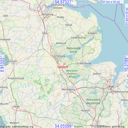
Geltorf GPS coordinates[2]
54° 28' 0.012" North, 9° 37' 0.012" East
| Map corner | latitude | longitude |
|---|---|---|
| Upper-left | 54.87327°, | 8.91355° |
| Center: | 54.46667°, | 9.61667° |
| Lower-right: | 54.05599°, | 10.3198° |
| Map W x H: | 90.9×90.9 km | = 56.5×56.5mi |
| max Lat: | 55.01917° ⇑2.2% North |
| Geltorf: | 54.46667° |
| min Lat: | ⇓97.8% South 47.40724° |
| min Long | Geltorf | max Long |
| 5.92978° | 9.61667° | 14.98853° |
| W 44.1%⇐ | ⇒55.9% E |
Elevation
Elevation of Geltorf is 24 m = 79 ft, and this is 225.1 m = 739 ft below average elevation for this country.
| Max E: |
1256 m = 4121 ft | 88.9% |
| Avg. | 249.1 m = 817 ft | |
| Geltorf | 24 m = 79 ft | |
Min E: |
-5 m = -16 ft | 11.1% |
See also: Germany elevation on elevation.city.
Geographical zone
Geltorf is located in North temperate zone (between Tropic of Cancer and the Arctic Circle). Distance of this North polar circle is 1345 km =835.7 mi to North.| Distance of | km | miles | from Geltorf |
|---|---|---|---|
| North Pole | 3950.9 | 2455 | to North |
| Arctic Circle | 1345 | 835.7 | to North |
| Tropic Cancer | 3450.2 | 2143.9 | to South |
| Equator | 6056.1 | 3763.1 | to South |


Nearby cities:
15 places around Geltorf: (largest is in red/bold)
• Ascheffel
6.5 km =4 mi,  124°
124°
• Borgwedel
4.9 km =3 mi,  41°
41°
• Brekendorf
5.2 km =3.2 mi,  167°
167°
• Busdorf
5.1 km =3.2 mi,  302°
302°
• Dannewerk
7.8 km =4.8 mi,  283°
283°
• Fahrdorf
3.9 km =2.4 mi,  343°
343°
• Fleckeby
5.7 km =3.5 mi,  71°
71°
• Güby
3.7 km =2.3 mi,  60°
60°
• Hummelfeld
6.5 km =4 mi,  90°
90°
• Hütten
7.5 km =4.7 mi, 119°
• Jagel
5.2 km =3.2 mi,  257°
257°
• Lottorf
3.7 km =2.3 mi,  240°
240°
• Owschlag
8.3 km =5.2 mi,  190°
190°
• Schleswig
7.2 km =4.5 mi,  328°
328°
• Selk
3.2 km =2 mi,  270°
270°
Sources, notices
• [Note1] Compared only with cities in Germany existing in our database
• [Src1] Map data: © OpenStreetMap contributors (CC-BY-SA)
• [Src2] Other city data from geonames.org with taken over terms of usage.
• [Src3] Geographical zone / Annual Mean Temperature by Robert A. Rohde @ Wikipedia
