Busdorf geodata
Busdorf (Schleswig-Holstein) is a seat of a fourth-order administrative division; located in Germany in Europe/Berlin (GMT+2) time zone. In our database, there are 11009 cities with bigger population. Compared to other cities in Germany, 98% of cities are located further ↓South; 57.1% of cities are located further →East and 89.3% of cities have higher elevation than Busdorf. Note1
Administrative division(s):
- Level 1: Schleswig-Holstein
- Level 3: Kreis Schleswig-Flensburg
- Level 4: Busdorf


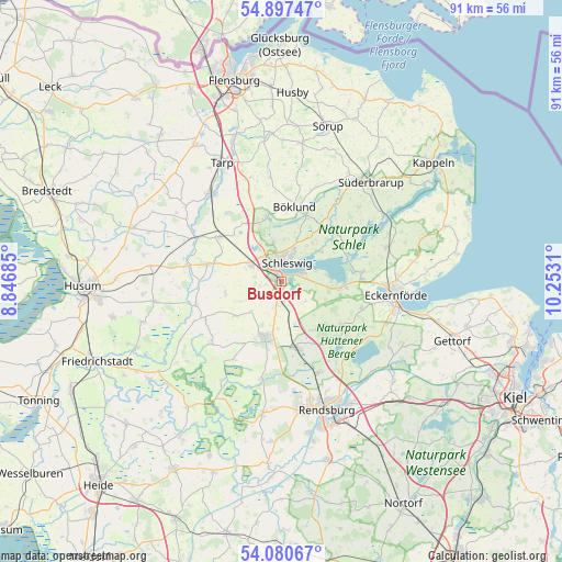
Busdorf GPS coordinates[2]
54° 29' 27.996" North, 9° 32' 59.892" East
| Map corner | latitude | longitude |
|---|---|---|
| Upper-left | 54.89747°, | 8.84685° |
| Center: | 54.49111°, | 9.54997° |
| Lower-right: | 54.08067°, | 10.2531° |
| Map W x H: | 90.8×90.8 km | = 56.4×56.4mi |
| max Lat: | 55.01917° ⇑2% North |
| Busdorf: | 54.49111° |
| min Lat: | ⇓98% South 47.40724° |
| min Long | Busdorf | max Long |
| 5.92978° | 9.54997° | 14.98853° |
| W 42.9%⇐ | ⇒57.1% E |
Elevation
Elevation of Busdorf is 23 m = 75 ft, and this is 226.1 m = 742 ft below average elevation for this country.
| Max E: |
1256 m = 4121 ft | 89.3% |
| Avg. | 249.1 m = 817 ft | |
| Busdorf | 23 m = 75 ft | |
Min E: |
-5 m = -16 ft | 10.7% |
See also: Germany elevation on elevation.city.
Geographical zone
Busdorf is located in North temperate zone (between Tropic of Cancer and the Arctic Circle). Distance of this North polar circle is 1342.3 km =834.1 mi to North.| Distance of | km | miles | from Busdorf |
|---|---|---|---|
| North Pole | 3948.2 | 2453.3 | to North |
| Arctic Circle | 1342.3 | 834.1 | to North |
| Tropic Cancer | 3452.9 | 2145.5 | to South |
| Equator | 6058.8 | 3764.8 | to South |


Nearby cities:
15 places around Busdorf: (largest is in red/bold)
• Borgwedel
7.6 km =4.7 mi,  82°
82°
• Dannewerk
3.3 km =2.1 mi,  254°
254°
• Fahrdorf
3.4 km =2.1 mi,  72°
72°
• Geltorf
5.1 km =3.2 mi,  122°
122°
• Güby
7.6 km =4.7 mi,  96°
96°
• Hüsby
4.4 km =2.7 mi,  282°
282°
• Jagel
3.9 km =2.4 mi,  191°
191°
• Klein Rheide
6.3 km =3.9 mi,  223°
223°
• Lottorf
4.7 km =2.9 mi,  166°
166°
• Lürschau
7.3 km =4.5 mi,  333°
333°
• Neuberend
6.6 km =4.1 mi,  350°
350°
• Schaalby
8.5 km =5.3 mi,  39°
39°
• Schleswig
3.4 km =2.1 mi,  9°
9°
• Schuby
5.2 km =3.2 mi,  303°
303°
• Selk
2.9 km =1.8 mi,  158°
158°
Sources, notices
• [Note1] Compared only with cities in Germany existing in our database
• [Src1] Map data: © OpenStreetMap contributors (CC-BY-SA)
• [Src2] Other city data from geonames.org with taken over terms of usage.
• [Src3] Geographical zone / Annual Mean Temperature by Robert A. Rohde @ Wikipedia
