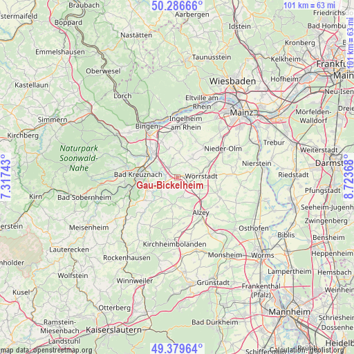
Gau-Bickelheim geodata
Gau-Bickelheim (Rheinland-Pfalz) is a seat of a fourth-order administrative division; located in Germany in Europe/Berlin (GMT+2) time zone. With population of 2,122 people, there are 4900 cities with bigger population in this country. Compared to other cities in Germany, 68% of cities are located further ↑North; 76.7% of cities are located further →East and 63.6% of cities have higher elevation than Gau-Bickelheim. Note1
Administrative division(s):
- Level 1: Rheinland-Pfalz
- Level 3: Landkreis Alzey-Worms
- Level 4: Gau-Bickelheim


Gau-Bickelheim GPS coordinates[2]
49° 50' 7.008" North, 8° 1' 14.016" East
| Map corner | latitude | longitude |
|---|---|---|
| Upper-left | 50.28666°, | 7.31743° |
| Center: | 49.83528°, | 8.02056° |
| Lower-right: | 49.37964°, | 8.72368° |
| Map W x H: | 100.9×100.8 km | = 62.7×62.6mi |
| max Lat: | 55.01917° ⇑68% North |
| Gau-Bickelheim: | 49.83528° |
| min Lat: | ⇓32% South 47.40724° |
| min Long | Gau-Bickelheim | max Long |
| 5.92978° | 8.02056° | 14.98853° |
| W 23.3%⇐ | ⇒76.7% E |
Elevation
Elevation of Gau-Bickelheim is 128 m = 420 ft, and this is 121.1 m = 397 ft below average elevation for this country.
| Max E: |
1256 m = 4121 ft | 63.6% |
| Avg. | 249.1 m = 817 ft | |
| Gau-Bickelheim | 128 m = 420 ft | |
Min E: |
-5 m = -16 ft | 36.4% |
See also: Germany elevation on elevation.city.
Geographical zone
Gau-Bickelheim is located in North temperate zone (between Tropic of Cancer and the Arctic Circle). Distance of this North polar circle is 1860 km =1155.8 mi to North.| Distance of | km | miles | from Gau-Bickelheim |
|---|---|---|---|
| North Pole | 4465.9 | 2775 | to North |
| Arctic Circle | 1860 | 1155.8 | to North |
| Tropic Cancer | 2935.2 | 1823.8 | to South |
| Equator | 5541.2 | 3443.1 | to South |


Nearby cities:
15 places around Gau-Bickelheim: (largest is in red/bold)
• Armsheim
3.8 km =2.4 mi,  137°
137°
• Badenheim
3.9 km =2.4 mi,  266°
266°
• Eckelsheim
4.7 km =2.9 mi,  214°
214°
• Gau-Weinheim
2.3 km =1.4 mi,  57°
57°
• Gumbsheim
3.4 km =2.1 mi,  232°
232°
• Pfaffen-Schwabenheim
5.3 km =3.3 mi,  287°
287°
• Pleitersheim
5.1 km =3.2 mi, 267°
• Sankt Johann
3.6 km =2.2 mi,  353°
353°
• Sprendlingen
4.4 km =2.7 mi,  322°
322°
• Sulzheim
5.2 km =3.2 mi,  80°
80°
• Vendersheim
4.9 km =3 mi,  44°
44°
• Wallertheim
2.2 km =1.4 mi,  89°
89°
• Wolfsheim
4.3 km =2.7 mi,  18°
18°
• Wöllstein
4.4 km =2.7 mi,  241°
241°
• Zotzenheim
5.2 km =3.2 mi,  312°
312°
Sources, notices
• [Note1] Compared only with cities in Germany existing in our database
• [Src1] Map data: © OpenStreetMap contributors (CC-BY-SA)
• [Src2] Other city data from geonames.org with taken over terms of usage.
• [Src3] Geographical zone / Annual Mean Temperature by Robert A. Rohde @ Wikipedia
