Bellingen geodata
Bellingen (Rheinland-Pfalz) is a seat of a fourth-order administrative division; located in Germany in Europe/Berlin (GMT+2) time zone. With population of 570 people, there are 8972 cities with bigger population in this country. Compared to other cities in Germany, 50.6% of cities are located further ↑North; 79% of cities are located further →East and 79.3% of cities have lower elevation than Bellingen. Note1


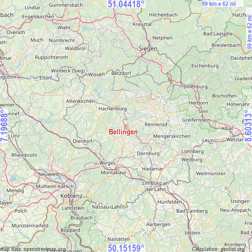
Bellingen GPS coordinates[2]
50° 36' 0" North, 7° 54' 0" East
| Map corner | latitude | longitude |
|---|---|---|
| Upper-left | 51.04418°, | 7.19688° |
| Center: | 50.6°, | 7.9° |
| Lower-right: | 50.15159°, | 8.60313° |
| Map W x H: | 99.2×99.2 km | = 61.6×61.6mi |
| max Lat: | 55.01917° ⇑50.6% North |
| Bellingen: | 50.6° |
| min Lat: | ⇓49.4% South 47.40724° |
| min Long | Bellingen | max Long |
| 5.92978° | 7.9° | 14.98853° |
| W 21%⇐ | ⇒79% E |
Elevation
Elevation of Bellingen is 429 m = 1407 ft, and this is 179.9 m = 590 ft above average elevation for this country.
| Max E: |
1256 m = 4121 ft | 20.7% |
| Bellingen | 429 m 1407 ft | |
| Avg. | 249.1 m = 817 ft | |
Min E: |
-5 m = -16 ft | 79.3% |
See also: Germany elevation on elevation.city.
Geographical zone
Bellingen is located in North temperate zone (between Tropic of Cancer and the Arctic Circle). Distance of this North polar circle is 1775 km =1102.9 mi to North.| Distance of | km | miles | from Bellingen |
|---|---|---|---|
| North Pole | 4380.9 | 2722.2 | to North |
| Arctic Circle | 1775 | 1102.9 | to North |
| Tropic Cancer | 3020.3 | 1876.7 | to South |
| Equator | 5626.2 | 3496 | to South |


Nearby cities:
15 places around Bellingen: (largest is in red/bold)
• Ailertchen
3 km =1.9 mi,  92°
92°
• Alpenrod
4.4 km =2.7 mi,  327°
327°
• Brandscheid
4.6 km =2.9 mi,  161°
161°
• Dreifelden
4.6 km =2.9 mi,  258°
258°
• Dreisbach
3 km =1.9 mi,  51°
51°
• Enspel
2.2 km =1.4 mi, 327°
• Hahn bei Marienberg
4.7 km =2.9 mi,  38°
38°
• Halbs
4.7 km =2.9 mi,  102°
102°
• Hardt
3.9 km =2.4 mi,  17°
17°
• Langenhahn
2.2 km =1.4 mi,  147°
147°
• Linden
3.5 km =2.2 mi,  270°
270°
• Lochum
2.5 km =1.6 mi,  284°
284°
• Rotenhain
1.2 km =0.7 mi, 270°
• Rothenbach
4 km =2.5 mi,  176°
176°
• Stockum-Püschen
0.6 km =0.4 mi,  25°
25°
Sources, notices
• [Note1] Compared only with cities in Germany existing in our database
• [Src1] Map data: © OpenStreetMap contributors (CC-BY-SA)
• [Src2] Other city data from geonames.org with taken over terms of usage.
• [Src3] Geographical zone / Annual Mean Temperature by Robert A. Rohde @ Wikipedia
