Linden geodata
Linden (Rheinland-Pfalz) is a seat of a fourth-order administrative division; located in Germany in Europe/Berlin (GMT+2) time zone. With population of 159 people, there are 10650 cities with bigger population in this country. Compared to other cities in Germany, 50.6% of cities are located further ↑North; 80.1% of cities are located further →East and 82.4% of cities have lower elevation than Linden. Note1


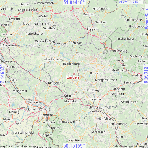
Linden GPS coordinates[2]
50° 36' 0" North, 7° 51' 0" East
| Map corner | latitude | longitude |
|---|---|---|
| Upper-left | 51.04418°, | 7.14687° |
| Center: | 50.6°, | 7.85° |
| Lower-right: | 50.15159°, | 8.55312° |
| Map W x H: | 99.2×99.2 km | = 61.6×61.6mi |
| max Lat: | 55.01917° ⇑50.6% North |
| Linden: | 50.6° |
| min Lat: | ⇓49.4% South 47.40724° |
| min Long | Linden | max Long |
| 5.92978° | 7.85° | 14.98853° |
| W 19.9%⇐ | ⇒80.1% E |
Elevation
Elevation of Linden is 449 m = 1473 ft, and this is 199.9 m = 656 ft above average elevation for this country.
| Max E: |
1256 m = 4121 ft | 17.6% |
| Linden | 449 m 1473 ft | |
| Avg. | 249.1 m = 817 ft | |
Min E: |
-5 m = -16 ft | 82.4% |
See also: Germany elevation on elevation.city.
Geographical zone
Linden is located in North temperate zone (between Tropic of Cancer and the Arctic Circle). Distance of this North polar circle is 1775 km =1102.9 mi to North.| Distance of | km | miles | from Linden |
|---|---|---|---|
| North Pole | 4380.9 | 2722.2 | to North |
| Arctic Circle | 1775 | 1102.9 | to North |
| Tropic Cancer | 3020.3 | 1876.7 | to South |
| Equator | 5626.2 | 3496 | to South |


Nearby cities:
15 places around Linden: (largest is in red/bold)
• Alpenrod
3.9 km =2.4 mi,  17°
17°
• Bellingen
3.5 km =2.2 mi,  90°
90°
• Dreifelden
1.4 km =0.9 mi,  225°
225°
• Enspel
3 km =1.9 mi,  51°
51°
• Freilingen
4.7 km =2.9 mi,  193°
193°
• Gehlert
4.9 km =3 mi,  342°
342°
• Hartenfels
5.3 km =3.3 mi,  236°
236°
• Langenhahn
5.1 km =3.2 mi,  111°
111°
• Lochum
1.3 km =0.8 mi,  61°
61°
• Rotenhain
2.4 km =1.5 mi, 90°
• Schenkelberg
5.1 km =3.2 mi,  248°
248°
• Steinebach
3.3 km =2.1 mi,  289°
289°
• Steinen
4 km =2.5 mi, 242°
• Stockum-Püschen
3.8 km =2.4 mi,  82°
82°
• Wölferlingen
4 km =2.5 mi,  178°
178°
Sources, notices
• [Note1] Compared only with cities in Germany existing in our database
• [Src1] Map data: © OpenStreetMap contributors (CC-BY-SA)
• [Src2] Other city data from geonames.org with taken over terms of usage.
• [Src3] Geographical zone / Annual Mean Temperature by Robert A. Rohde @ Wikipedia
