Belgweiler geodata
Belgweiler (Rheinland-Pfalz) is a seat of a fourth-order administrative division; located in Germany in Europe/Berlin (GMT+2) time zone. With population of 205 people, there are 10451 cities with bigger population in this country. Compared to other cities in Germany, 65.2% of cities are located further ↑North; 87.4% of cities are located further →East and 66.5% of cities have lower elevation than Belgweiler. Note1
Administrative division(s):
- Level 1: Rheinland-Pfalz
- Level 3: Rhein-Hunsrück-Kreis
- Level 4: Belgweiler


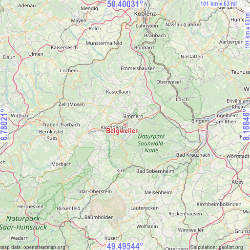
Belgweiler GPS coordinates[2]
49° 57' 0" North, 7° 28' 59.988" East
| Map corner | latitude | longitude |
|---|---|---|
| Upper-left | 50.40031°, | 6.78021° |
| Center: | 49.95°, | 7.48333° |
| Lower-right: | 49.49544°, | 8.18646° |
| Map W x H: | 100.6×100.6 km | = 62.5×62.5mi |
| max Lat: | 55.01917° ⇑65.2% North |
| Belgweiler: | 49.95° |
| min Lat: | ⇓34.8% South 47.40724° |
| min Long | Belgweiler | max Long |
| 5.92978° | 7.48333° | 14.98853° |
| W 12.6%⇐ | ⇒87.4% E |
Elevation
Elevation of Belgweiler is 332 m = 1089 ft, and this is 82.9 m = 272 ft above average elevation for this country.
| Max E: |
1256 m = 4121 ft | 33.5% |
| Belgweiler | 332 m 1089 ft | |
| Avg. | 249.1 m = 817 ft | |
Min E: |
-5 m = -16 ft | 66.5% |
See also: Germany elevation on elevation.city.
Geographical zone
Belgweiler is located in North temperate zone (between Tropic of Cancer and the Arctic Circle). Distance of this North polar circle is 1847.3 km =1147.9 mi to North.| Distance of | km | miles | from Belgweiler |
|---|---|---|---|
| North Pole | 4453.1 | 2767 | to North |
| Arctic Circle | 1847.3 | 1147.9 | to North |
| Tropic Cancer | 2948 | 1831.8 | to South |
| Equator | 5553.9 | 3451 | to South |


Nearby cities:
15 places around Belgweiler: (largest is in red/bold)
• Fronhofen
3.9 km =2.4 mi,  342°
342°
• Holzbach
3.6 km =2.2 mi,  90°
90°
• Keidelheim
3.9 km =2.4 mi,  17°
17°
• Kümbdchen
4.4 km =2.7 mi,  32°
32°
• Maitzborn
4 km =2.5 mi,  242°
242°
• Mengerschied
3.9 km =2.4 mi,  162°
162°
• Nannhausen
1.9 km =1.2 mi,  0°
0°
• Ohlweiler
2.2 km =1.4 mi, 32°
• Oppertshausen
1.2 km =0.7 mi,  270°
270°
• Ravengiersburg
1.9 km =1.2 mi,  180°
180°
• Rödern
2.4 km =1.5 mi, 270°
• Sargenroth
3 km =1.9 mi,  127°
127°
• Schönborn
1.2 km =0.7 mi, 270°
• Unzenberg
3.8 km =2.4 mi,  304°
304°
• Womrath
4.4 km =2.7 mi,  212°
212°
Sources, notices
• [Note1] Compared only with cities in Germany existing in our database
• [Src1] Map data: © OpenStreetMap contributors (CC-BY-SA)
• [Src2] Other city data from geonames.org with taken over terms of usage.
• [Src3] Geographical zone / Annual Mean Temperature by Robert A. Rohde @ Wikipedia
