Altlay geodata
Altlay (Rheinland-Pfalz) is a seat of a fourth-order administrative division; located in Germany in Europe/Berlin (GMT+2) time zone. With population of 515 people, there are 9292 cities with bigger population in this country. Compared to other cities in Germany, 63.9% of cities are located further ↑North; 90.4% of cities are located further →East and 67.2% of cities have lower elevation than Altlay. Note1


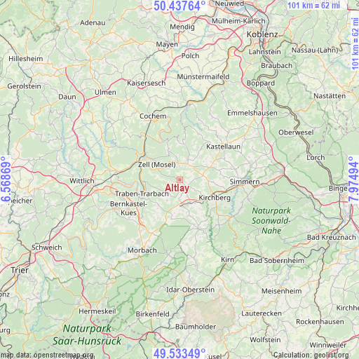
Altlay GPS coordinates[2]
49° 59' 15.684" North, 7° 16' 18.552" East
| Map corner | latitude | longitude |
|---|---|---|
| Upper-left | 50.43764°, | 6.56869° |
| Center: | 49.98769°, | 7.27182° |
| Lower-right: | 49.53349°, | 7.97494° |
| Map W x H: | 100.5×100.5 km | = 62.4×62.4mi |
| max Lat: | 55.01917° ⇑63.9% North |
| Altlay: | 49.98769° |
| min Lat: | ⇓36.1% South 47.40724° |
| min Long | Altlay | max Long |
| 5.92978° | 7.27182° | 14.98853° |
| W 9.6%⇐ | ⇒90.4% E |
Elevation
Elevation of Altlay is 337 m = 1106 ft, and this is 87.9 m = 288 ft above average elevation for this country.
| Max E: |
1256 m = 4121 ft | 32.8% |
| Altlay | 337 m 1106 ft | |
| Avg. | 249.1 m = 817 ft | |
Min E: |
-5 m = -16 ft | 67.2% |
See also: Germany elevation on elevation.city.
Geographical zone
Altlay is located in North temperate zone (between Tropic of Cancer and the Arctic Circle). Distance of this North polar circle is 1843.1 km =1145.2 mi to North.| Distance of | km | miles | from Altlay |
|---|---|---|---|
| North Pole | 4449 | 2764.5 | to North |
| Arctic Circle | 1843.1 | 1145.2 | to North |
| Tropic Cancer | 2952.2 | 1834.4 | to South |
| Equator | 5558.1 | 3453.6 | to South |


Nearby cities:
15 places around Altlay: (largest is in red/bold)
• Belg
2.1 km =1.3 mi,  103°
103°
• Blankenrath
6.1 km =3.8 mi,  20°
20°
• Bärenbach
4.7 km =2.9 mi,  154°
154°
• Hahn
2.4 km =1.5 mi,  188°
188°
• Lautzenhausen
6.1 km =3.8 mi,  183°
183°
• Panzweiler
3.8 km =2.4 mi,  32°
32°
• Peterswald-Löffelscheid
2.4 km =1.5 mi,  55°
55°
• Raversbeuren
5 km =3.1 mi,  213°
213°
• Rödelhausen
4.6 km =2.9 mi,  72°
72°
• Schauren
3.2 km =2 mi,  353°
353°
• Schwarzen
5 km =3.1 mi,  117°
117°
• Tellig
5.3 km =3.3 mi,  342°
342°
• Todenroth
6.1 km =3.8 mi,  112°
112°
• Walhausen
5.1 km =3.2 mi,  9°
9°
• Würrich
2.1 km =1.3 mi, 103°
Sources, notices
• [Note1] Compared only with cities in Germany existing in our database
• [Src1] Map data: © OpenStreetMap contributors (CC-BY-SA)
• [Src2] Other city data from geonames.org with taken over terms of usage.
• [Src3] Geographical zone / Annual Mean Temperature by Robert A. Rohde @ Wikipedia
