Offenbach-Hundheim geodata
Offenbach-Hundheim (Rheinland-Pfalz) is a seat of a fourth-order administrative division; located in Germany in Europe/Berlin (GMT+2) time zone. With population of 1,310 people, there are 6283 cities with bigger population in this country. Compared to other cities in Germany, 73.3% of cities are located further ↑North; 85.9% of cities are located further →East and 56.7% of cities have higher elevation than Offenbach-Hundheim. Note1
Administrative division(s):
- Level 1: Rheinland-Pfalz
- Level 3: Landkreis Kusel
- Level 4: Offenbach-Hundheim


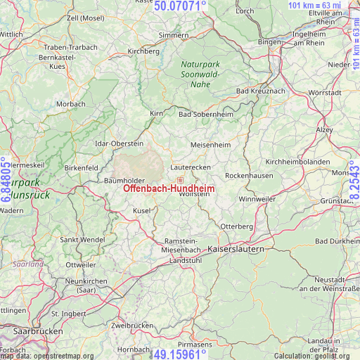
Offenbach-Hundheim GPS coordinates[2]
49° 37' 2.244" North, 7° 33' 4.212" East
| Map corner | latitude | longitude |
|---|---|---|
| Upper-left | 50.07071°, | 6.84805° |
| Center: | 49.61729°, | 7.55117° |
| Lower-right: | 49.15961°, | 8.2543° |
| Map W x H: | 101.3×101.3 km | = 62.9×62.9mi |
| max Lat: | 55.01917° ⇑73.3% North |
| Offenbach-Hundheim: | 49.61729° |
| min Lat: | ⇓26.7% South 47.40724° |
| min Long | Offenbach-Hundh | max Long |
| 5.92978° | 7.55117° | 14.98853° |
| W 14.1%⇐ | ⇒85.9% E |
Elevation
Elevation of Offenbach-Hundheim is 177 m = 581 ft, and this is 72.1 m = 237 ft below average elevation for this country.
| Max E: |
1256 m = 4121 ft | 56.7% |
| Avg. | 249.1 m = 817 ft | |
| Offenbach-Hundheim | 177 m = 581 ft | |
Min E: |
-5 m = -16 ft | 43.3% |
See also: Germany elevation on elevation.city.
Geographical zone
Offenbach-Hundheim is located in North temperate zone (between Tropic of Cancer and the Arctic Circle). Distance of this North polar circle is 1884.2 km =1170.8 mi to North.| Distance of | km | miles | from Offenbach-Hundheim |
|---|---|---|---|
| North Pole | 4490.1 | 2790 | to North |
| Arctic Circle | 1884.2 | 1170.8 | to North |
| Tropic Cancer | 2911 | 1808.8 | to South |
| Equator | 5516.9 | 3428 | to South |


Nearby cities:
15 places around Offenbach-Hundheim: (largest is in red/bold)
• Aschbach
3 km =1.9 mi,  129°
129°
• Buborn
2.5 km =1.6 mi,  341°
341°
• Deimberg
3.1 km =1.9 mi,  305°
305°
• Grumbach
3.8 km =2.4 mi,  17°
17°
• Hausweiler
3.8 km =2.4 mi, 17°
• Heinzenhausen
3.9 km =2.4 mi,  63°
63°
• Herren-Sulzbach
3.9 km =2.4 mi, 340°
• Hinzweiler
3.8 km =2.4 mi,  181°
181°
• Horschbach
4 km =2.5 mi,  198°
198°
• Kirrweiler
4.1 km =2.5 mi,  295°
295°
• Lohnweiler
3.9 km =2.4 mi, 63°
• Nerzweiler
1.9 km =1.2 mi, 182°
• Oberweiler im Tal
3.8 km =2.4 mi, 181°
• Sankt Julian
2.5 km =1.6 mi,  268°
268°
• Wiesweiler
2.1 km =1.3 mi,  32°
32°
Sources, notices
• [Note1] Compared only with cities in Germany existing in our database
• [Src1] Map data: © OpenStreetMap contributors (CC-BY-SA)
• [Src2] Other city data from geonames.org with taken over terms of usage.
• [Src3] Geographical zone / Annual Mean Temperature by Robert A. Rohde @ Wikipedia
