Horschbach geodata
Horschbach (Rheinland-Pfalz) is a seat of a fourth-order administrative division; located in Germany in Europe/Berlin (GMT+2) time zone. With population of 285 people, there are 10114 cities with bigger population in this country. Compared to other cities in Germany, 74.2% of cities are located further ↑North; 86.4% of cities are located further →East and 62.5% of cities have lower elevation than Horschbach. Note1


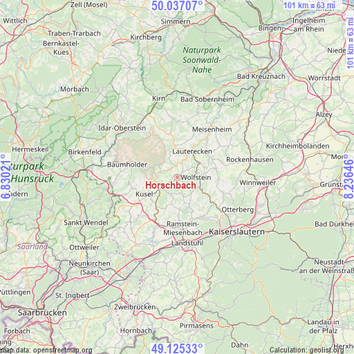
Horschbach GPS coordinates[2]
49° 34' 59.988" North, 7° 31' 59.988" East
| Map corner | latitude | longitude |
|---|---|---|
| Upper-left | 50.03707°, | 6.83021° |
| Center: | 49.58333°, | 7.53333° |
| Lower-right: | 49.12533°, | 8.23646° |
| Map W x H: | 101.4×101.4 km | = 63×63mi |
| max Lat: | 55.01917° ⇑74.2% North |
| Horschbach: | 49.58333° |
| min Lat: | ⇓25.8% South 47.40724° |
| min Long | Horschbach | max Long |
| 5.92978° | 7.53333° | 14.98853° |
| W 13.6%⇐ | ⇒86.4% E |
Elevation
Elevation of Horschbach is 305 m = 1001 ft, and this is 55.9 m = 183 ft above average elevation for this country.
| Max E: |
1256 m = 4121 ft | 37.5% |
| Horschbach | 305 m 1001 ft | |
| Avg. | 249.1 m = 817 ft | |
Min E: |
-5 m = -16 ft | 62.5% |
See also: Germany elevation on elevation.city.
Geographical zone
Horschbach is located in North temperate zone (between Tropic of Cancer and the Arctic Circle). Distance of this North polar circle is 1888 km =1173.1 mi to North.| Distance of | km | miles | from Horschbach |
|---|---|---|---|
| North Pole | 4493.9 | 2792.4 | to North |
| Arctic Circle | 1888 | 1173.1 | to North |
| Tropic Cancer | 2907.2 | 1806.4 | to South |
| Equator | 5513.1 | 3425.7 | to South |


Nearby cities:
15 places around Horschbach: (largest is in red/bold)
• Aschbach
4.1 km =2.5 mi,  62°
62°
• Bosenbach
4.8 km =3 mi,  182°
182°
• Elzweiler
1.2 km =0.7 mi,  270°
270°
• Eßweiler
3.6 km =2.2 mi,  141°
141°
• Hinzweiler
1.2 km =0.7 mi,  90°
90°
• Jettenbach
5.7 km =3.5 mi,  162°
162°
• Nerzweiler
2.2 km =1.4 mi,  32°
32°
• Niederalben
5.1 km =3.2 mi,  291°
291°
• Niederstaufenbach
5.7 km =3.5 mi,  192°
192°
• Oberweiler im Tal
1.2 km =0.7 mi, 90°
• Offenbach-Hundheim
4 km =2.5 mi,  18°
18°
• Rathsweiler
5.1 km =3.2 mi, 291°
• Sankt Julian
3.9 km =2.4 mi,  342°
342°
• Welchweiler
2.4 km =1.5 mi, 270°
• Wolfstein
5.2 km =3.2 mi, 89°
Sources, notices
• [Note1] Compared only with cities in Germany existing in our database
• [Src1] Map data: © OpenStreetMap contributors (CC-BY-SA)
• [Src2] Other city data from geonames.org with taken over terms of usage.
• [Src3] Geographical zone / Annual Mean Temperature by Robert A. Rohde @ Wikipedia
