Gropiusstadt geodata
Gropiusstadt (Berlin) is a section of populated place; located in Germany in Europe/Berlin (GMT+2) time zone. With population of 36,052 people, there are 371 cities with bigger population in this country. Compared to other cities in Germany, 76.5% of cities are located further ↓South; 95.5% of cities are located further ←West and 78.3% of cities have higher elevation than Gropiusstadt. Note1


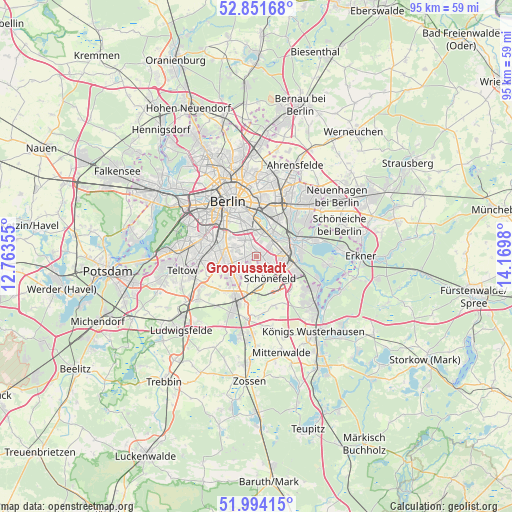
Gropiusstadt GPS coordinates[2]
52° 25' 30" North, 13° 28' 0.012" East
| Map corner | latitude | longitude |
|---|---|---|
| Upper-left | 52.85168°, | 12.76355° |
| Center: | 52.425°, | 13.46667° |
| Lower-right: | 51.99415°, | 14.1698° |
| Map W x H: | 95.3×95.3 km | = 59.2×59.2mi |
| max Lat: | 55.01917° ⇑23.5% North |
| Gropiusstadt: | 52.425° |
| min Lat: | ⇓76.5% South 47.40724° |
| min Long | Gropiusstadt | max Long |
| 5.92978° | 13.46667° | 14.98853° |
| W 95.5%⇐ | ⇒4.5% E |
Elevation
Elevation of Gropiusstadt is 52 m = 171 ft, and this is 197.1 m = 647 ft below average elevation for this country.
| Max E: |
1256 m = 4121 ft | 78.3% |
| Avg. | 249.1 m = 817 ft | |
| Gropiusstadt | 52 m = 171 ft | |
Min E: |
-5 m = -16 ft | 21.7% |
See also: Germany elevation on elevation.city.
Geographical zone
Gropiusstadt is located in North temperate zone (between Tropic of Cancer and the Arctic Circle). Distance of this North polar circle is 1572.1 km =976.9 mi to North.| Distance of | km | miles | from Gropiusstadt |
|---|---|---|---|
| North Pole | 4177.9 | 2596 | to North |
| Arctic Circle | 1572.1 | 976.9 | to North |
| Tropic Cancer | 3223.2 | 2002.8 | to South |
| Equator | 5829.1 | 3622 | to South |


Nearby cities:
15 places around Gropiusstadt: (largest is in red/bold)
• Adlershof
5.7 km =3.5 mi,  78°
78°
• Altglienicke
4.9 km =3 mi,  108°
108°
• Baumschulenweg
4.7 km =2.9 mi,  15°
15°
• Britz
3 km =1.9 mi,  311°
311°
• Buckow
0.9 km =0.6 mi,  330°
330°
• Johannisthal
3.6 km =2.2 mi,  48°
48°
• Lichtenrade
5 km =3.1 mi,  234°
234°
• Mariendorf
6 km =3.7 mi,  283°
283°
• Neukölln
6.3 km =3.9 mi,  337°
337°
• Niederschöneweide
4.8 km =3 mi,  44°
44°
• Oberschöneweide
5.4 km =3.4 mi, 42°
• Plänterwald
6.2 km =3.9 mi,  3°
3°
• Rudow
1.3 km =0.8 mi,  94°
94°
• Schönefeld
4.7 km =2.9 mi,  147°
147°
• Tempelhof
6.5 km =4 mi,  315°
315°
Sources, notices
• [Note1] Compared only with cities in Germany existing in our database
• [Src1] Map data: © OpenStreetMap contributors (CC-BY-SA)
• [Src2] Other city data from geonames.org with taken over terms of usage.
• [Src3] Geographical zone / Annual Mean Temperature by Robert A. Rohde @ Wikipedia
