Pizarrete geodata
Pizarrete (Peravia) is a populated place; located in Dominican Republic in America/Santo_Domingo (GMT-4) time zone. With population of 2,695 people, there are 152 cities with bigger population in this country. Compared to other cities in Dominican Republic, 89.6% of cities are located further ↑North; 66.8% of cities are located further ←West and 55% of cities have higher elevation than Pizarrete. Note1
Administrative division(s):
- Level 1: Peravia
- Level 2: Nizao
- Level 3: Pizarrete (D. M.).
- Level 4: Pizarrete (Zona Urbana)


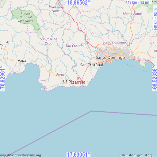
Pizarrete GPS coordinates[2]
18° 17' 57.66" North, 70° 13' 35.328" West
| Map corner | latitude | longitude |
|---|---|---|
| Upper-left | 18.96562°, | -70.92961° |
| Center: | 18.29935°, | -70.22648° |
| Lower-right: | 17.63051°, | -69.52336° |
| Map W x H: | 148.5×148.5 km | = 92.3×92.3mi |
| max Lat: | 19.89131° ⇑89.6% North |
| Pizarrete: | 18.29935° |
| min Lat: | ⇓10.4% South 17.80136° |
| min Long | Pizarrete | max Long |
| -71.85022° | -70.22648° | -68.40431° |
| W 66.8%⇐ | ⇒33.2% E |
Elevation
Elevation of Pizarrete is 57 m = 187 ft, and this is 109.3 m = 359 ft below average elevation for this country.
| Max E: |
1242 m = 4075 ft | 55% |
| Avg. | 166.3 m = 546 ft | |
| Pizarrete | 57 m = 187 ft | |
Min E: |
5 m = 16 ft | 45% |
See also: Dominican Republic elevation on elevation.city.
Geographical zone
Pizarrete is located in North Torrid zone (between Equator and Tropic of Cancer). Distance of this Northern Tropic circle is 571.2 km =354.9 mi to North.| Distance of | km | miles | from Pizarrete |
|---|---|---|---|
| North Pole | 7972.4 | 4953.8 | to North |
| Arctic Circle | 5366.5 | 3334.6 | to North |
| Tropic Cancer | 571.2 | 354.9 | to North |
| Equator | 2034.7 | 1264.3 | to South |


Nearby cities:
15 places around Pizarrete: (largest is in red/bold)
• Bajos de Haina
24.1 km =15 mi,  57°
57°
• Baní
11.3 km =7 mi,  258°
258°
• Bella Vista
34.4 km =21.4 mi, 59°
• Cambita Garabitos
17.5 km =10.9 mi,  9°
9°
• El Cacao
26.4 km =16.4 mi,  343°
343°
• El Carril
26.8 km =16.7 mi,  51°
51°
• Matanzas
21.1 km =13.1 mi,  252°
252°
• Nizao
6.1 km =3.8 mi,  163°
163°
• Paya
8.4 km =5.2 mi,  240°
240°
• Sabana Buey
31.5 km =19.6 mi, 264°
• Sabana Grande de Palenque
9.2 km =5.7 mi,  116°
116°
• San Cristóbal
18.7 km =11.6 mi, 45°
• San Gregorio de Nigua
17.8 km =11.1 mi, 58°
• Santo Domingo Oeste
32.7 km =20.3 mi, 46°
• Yaguate
6.2 km =3.9 mi, 50°
Sources, notices
• [Note1] Compared only with cities in Dominican Republic existing in our database
• [Src1] Map data: © OpenStreetMap contributors (CC-BY-SA)
• [Src2] Other city data from geonames.org with taken over terms of usage.
• [Src3] Geographical zone / Annual Mean Temperature by Robert A. Rohde @ Wikipedia
