Fundación geodata
Fundación (Barahona) is a seat of a second-order administrative division; located in Dominican Republic in America/Santo_Domingo (GMT-4) time zone. With population of 2,511 people, there are 157 cities with bigger population in this country. Compared to other cities in Dominican Republic, 91.5% of cities are located further ↑North; 75.8% of cities are located further →East and 85.8% of cities have higher elevation than Fundación. Note1
Administrative division(s):
- Level 1: Barahona
- Level 2: Fundación
- Level 3: Fundación
- Level 4: Fundación (Zona Urbana)


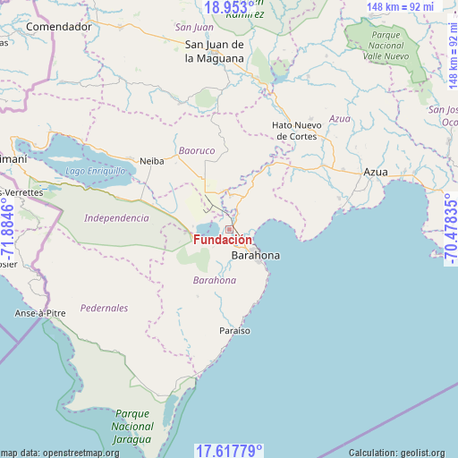
Fundación GPS coordinates[2]
18° 17' 12.048" North, 71° 10' 53.292" West
| Map corner | latitude | longitude |
|---|---|---|
| Upper-left | 18.953°, | -71.8846° |
| Center: | 18.28668°, | -71.18147° |
| Lower-right: | 17.61779°, | -70.47835° |
| Map W x H: | 148.5×148.5 km | = 92.3×92.3mi |
| max Lat: | 19.89131° ⇑91.5% North |
| Fundación: | 18.28668° |
| min Lat: | ⇓8.5% South 17.80136° |
| min Long | Fundación | max Long |
| -71.85022° | -71.18147° | -68.40431° |
| W 24.2%⇐ | ⇒75.8% E |
Elevation
Elevation of Fundación is 16 m = 52 ft, and this is 150.3 m = 493 ft below average elevation for this country.
| Max E: |
1242 m = 4075 ft | 85.8% |
| Avg. | 166.3 m = 546 ft | |
| Fundación | 16 m = 52 ft | |
Min E: |
5 m = 16 ft | 14.2% |
See also: Dominican Republic elevation on elevation.city.
Geographical zone
Fundación is located in North Torrid zone (between Equator and Tropic of Cancer). Distance of this Northern Tropic circle is 572.6 km =355.8 mi to North.| Distance of | km | miles | from Fundación |
|---|---|---|---|
| North Pole | 7973.8 | 4954.7 | to North |
| Arctic Circle | 5367.9 | 3335.5 | to North |
| Tropic Cancer | 572.6 | 355.8 | to North |
| Equator | 2033.3 | 1263.4 | to South |


Nearby cities:
15 places around Fundación: (largest is in red/bold)
• Cabral
5.5 km =3.4 mi,  222°
222°
• Cachón
4.3 km =2.7 mi,  190°
190°
• Canoa
8 km =5 mi,  17°
17°
• Cristóbal
11.8 km =7.3 mi,  273°
273°
• El Palmar
15.4 km =9.6 mi,  333°
333°
• El Peñón
1.1 km =0.7 mi,  345°
345°
• Jaquimeyes
3.5 km =2.2 mi,  37°
37°
• La Ciénaga
25.5 km =15.8 mi,  161°
161°
• La Uvilla
8.9 km =5.5 mi,  339°
339°
• Las Salinas
14.3 km =8.9 mi,  264°
264°
• Pescadería
2.7 km =1.7 mi,  142°
142°
• Polo
25.7 km =16 mi,  205°
205°
• Santa Cruz de Barahona
12.2 km =7.6 mi, 135°
• Tamayo
12.2 km =7.6 mi, 349°
• Vicente Noble
10.9 km =6.8 mi,  0°
0°
Sources, notices
• [Note1] Compared only with cities in Dominican Republic existing in our database
• [Src1] Map data: © OpenStreetMap contributors (CC-BY-SA)
• [Src2] Other city data from geonames.org with taken over terms of usage.
• [Src3] Geographical zone / Annual Mean Temperature by Robert A. Rohde @ Wikipedia
