Fantino geodata
Fantino (Sánchez Ramírez) is a populated place; located in Dominican Republic in America/Santo_Domingo (GMT-4) time zone. With population of 10,024 people, there are 68 cities with bigger population in this country. Compared to other cities in Dominican Republic, 59.7% of cities are located further ↓South; 63.5% of cities are located further ←West and 55.5% of cities have higher elevation than Fantino. Note1
Administrative division(s):
- Level 1: Sánchez Ramírez
- Level 2: Fantino
- Level 3: Fantino
- Level 4: Fantino (Zona Urbana)


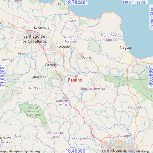
Fantino GPS coordinates[2]
19° 7' 17.328" North, 70° 17' 58.992" West
| Map corner | latitude | longitude |
|---|---|---|
| Upper-left | 19.78446°, | -71.00285° |
| Center: | 19.12148°, | -70.29972° |
| Lower-right: | 18.45583°, | -69.5966° |
| Map W x H: | 147.7×147.7 km | = 91.8×91.8mi |
| max Lat: | 19.89131° ⇑40.3% North |
| Fantino: | 19.12148° |
| min Lat: | ⇓59.7% South 17.80136° |
| min Long | Fantino | max Long |
| -71.85022° | -70.29972° | -68.40431° |
| W 63.5%⇐ | ⇒36.5% E |
Elevation
Elevation of Fantino is 56 m = 184 ft, and this is 110.3 m = 362 ft below average elevation for this country.
| Max E: |
1242 m = 4075 ft | 55.5% |
| Avg. | 166.3 m = 546 ft | |
| Fantino | 56 m = 184 ft | |
Min E: |
5 m = 16 ft | 44.5% |
See also: Dominican Republic elevation on elevation.city.
Geographical zone
Fantino is located in North Torrid zone (between Equator and Tropic of Cancer). Distance of this Northern Tropic circle is 479.8 km =298.1 mi to North.| Distance of | km | miles | from Fantino |
|---|---|---|---|
| North Pole | 7881 | 4897 | to North |
| Arctic Circle | 5275.1 | 3277.8 | to North |
| Tropic Cancer | 479.8 | 298.1 | to North |
| Equator | 2126.1 | 1321.1 | to South |


Nearby cities:
15 places around Fantino: (largest is in red/bold)
• Bonao
23.5 km =14.6 mi,  209°
209°
• Cenoví
16.4 km =10.2 mi,  334°
334°
• Concepción de La Vega
26.6 km =16.5 mi,  294°
294°
• Cotuí
17.5 km =10.9 mi,  115°
115°
• Hostos
30.1 km =18.7 mi,  77°
77°
• Jima Abajo
8.1 km =5 mi,  279°
279°
• La Peña
21.9 km =13.6 mi,  37°
37°
• Las Guáranas
12.5 km =7.8 mi,  50°
50°
• Pimentel
21.2 km =13.2 mi,  70°
70°
• Rincón
11.2 km =7 mi,  268°
268°
• Sabana del Puerto
13.7 km =8.5 mi,  243°
243°
• San Francisco de Macorís
20.6 km =12.8 mi,  13°
13°
• Tenares
28.6 km =17.8 mi,  349°
349°
• Villa La Mata
12.2 km =7.6 mi,  163°
163°
• Villa Tapia
23.7 km =14.7 mi, 327°
Sources, notices
• [Note1] Compared only with cities in Dominican Republic existing in our database
• [Src1] Map data: © OpenStreetMap contributors (CC-BY-SA)
• [Src2] Other city data from geonames.org with taken over terms of usage.
• [Src3] Geographical zone / Annual Mean Temperature by Robert A. Rohde @ Wikipedia
