Assab geodata
Assab (Southern Red Sea) is a seat of a first-order administrative division; located in Eritrea in Africa/Asmara (GMT+3) time zone. With population of 21,300 people, there are 3 cities with bigger population in this country. Compared to other cities in Eritrea, 100% of cities are located further ↑North; 100% of cities are located further ←West and 83.3% of cities have higher elevation than Assab. Note1


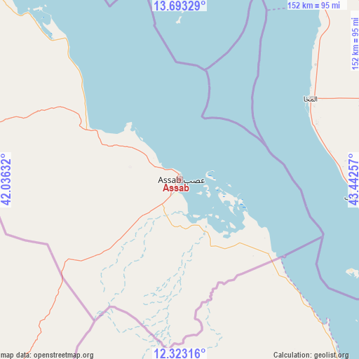
Assab GPS coordinates[2]
13° 0' 33.012" North, 42° 44' 21.984" East
| Map corner | latitude | longitude |
|---|---|---|
| Upper-left | 13.69329°, | 42.03632° |
| Center: | 13.00917°, | 42.73944° |
| Lower-right: | 12.32316°, | 43.44257° |
| Map W x H: | 152.3×152.3 km | = 94.6×94.6mi |
| max Lat: | 15.77792° ⇑100% North |
| Assab: | 13.00917° |
| min Lat: | ⇓0% South 13.00917° |
| min Long | Assab | max Long |
| 36.6575° | 42.73944° | 42.73944° |
| W 100%⇐ | ⇒0% E |
Elevation
Elevation of Assab is 22 m = 72 ft, and this is 1266.5 m = 4155 ft below average elevation for this country.
| Max E: |
2528 m = 8294 ft | 83.3% |
| Avg. | 1288.5 m = 4227 ft | |
| Assab | 22 m = 72 ft | |
Min E: |
7 m = 23 ft | 16.7% |
See also: Eritrea elevation on elevation.city.
Geographical zone
Assab is located in North Torrid zone (between Equator and Tropic of Cancer). Distance of this Northern Tropic circle is 1159.4 km =720.4 mi to North.| Distance of | km | miles | from Assab |
|---|---|---|---|
| North Pole | 8560.6 | 5319.3 | to North |
| Arctic Circle | 5954.7 | 3700.1 | to North |
| Tropic Cancer | 1159.4 | 720.4 | to North |
| Equator | 1446.5 | 898.8 | to South |


Nearby cities:
2 places around Assab: (largest is in red/bold)
• Adi Keyh
416.3 km =258.7 mi,  299°
299°
• Edd
152.6 km =94.8 mi,  312°
312°
Sources, notices
• [Note1] Compared only with cities in Eritrea existing in our database
• [Src1] Map data: © OpenStreetMap contributors (CC-BY-SA)
• [Src2] Other city data from geonames.org with taken over terms of usage.
• [Src3] Geographical zone / Annual Mean Temperature by Robert A. Rohde @ Wikipedia
