Talayuela geodata
Talayuela (Extremadura) is a populated place; located in Spain in Europe/Madrid (GMT+2) time zone. With population of 10,189 people, there are 848 cities with bigger population in this country. Compared to other cities in Spain, 70.4% of cities are located further ↑North; 80.3% of cities are located further →East and 75.6% of cities have higher elevation than Talayuela. Note1
Administrative division(s):
- Level 1: Extremadura
- Level 2: Provincia de Cáceres
- Level 3: Navalmoral de la Mata


Talayuela GPS coordinates[2]
39° 59' 13.236" North, 5° 36' 35.352" West
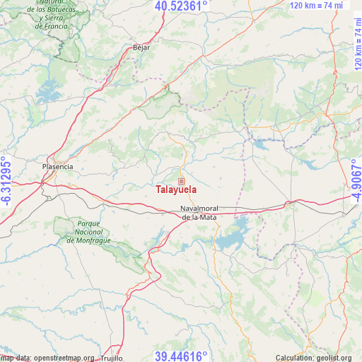
| Map corner | latitude | longitude |
|---|---|---|
| Upper-left | 40.52361°, | -6.31295° |
| Center: | 39.98701°, | -5.60982° |
| Lower-right: | 39.44616°, | -4.9067° |
| Map W x H: | 119.8×119.8 km | = 74.4×74.4mi |
| max Lat: | 43.74134° ⇑70.4% North |
| Talayuela: | 39.98701° |
| min Lat: | ⇓29.6% South 27.64134° |
| min Long | Talayuela | max Long |
| -18.00367° | -5.60982° | 4.2899° |
| W 19.7%⇐ | ⇒80.3% E |
Elevation
Elevation of Talayuela is 290 m = 951 ft, and this is 308 m = 1010 ft below average elevation for this country.
| Max E: |
1682 m = 5518 ft | 75.6% |
| Avg. | 598 m = 1962 ft | |
| Talayuela | 290 m = 951 ft | |
Min E: |
0 m = 0 ft | 24.4% |
See also: Spain elevation on elevation.city.
Geographical zone
Talayuela is located in North temperate zone (between Tropic of Cancer and the Arctic Circle). Distance of this Northern Tropic circle is 1840.2 km =1143.4 mi to South.| Distance of | km | miles | from Talayuela |
|---|---|---|---|
| North Pole | 5560.9 | 3455.4 | to North |
| Arctic Circle | 2955 | 1836.2 | to North |
| Tropic Cancer | 1840.2 | 1143.4 | to South |
| Equator | 4446.1 | 2762.7 | to South |


Nearby cities:
15 places around Talayuela: (largest is in red/bold)
• Aldeanueva de la Vera
17.4 km =10.8 mi,  333°
333°
• Casatejada
12.8 km =8 mi,  208°
208°
• Collado
12.2 km =7.6 mi,  309°
309°
• Cuacos
16.4 km =10.2 mi,  323°
323°
• Jarandilla de la Vera
16.4 km =10.2 mi,  344°
344°
• Jaraíz de la Vera
14.7 km =9.1 mi,  303°
303°
• Losar de la Vera
15 km =9.3 mi,  1°
1°
• Majadas
12.6 km =7.8 mi,  247°
247°
• Millanes
15.5 km =9.6 mi,  170°
170°
• Navalmoral de la Mata
12.1 km =7.5 mi,  150°
150°
• Robledillo de la Vera
12.8 km =8 mi,  7°
7°
• Saucedilla
16 km =9.9 mi,  201°
201°
• Tiétar
11.9 km =7.4 mi,  66°
66°
• Torremenga
15.5 km =9.6 mi, 295°
• Viandar de la Vera
16.3 km =10.1 mi,  22°
22°
Sources, notices
• [Note1] Compared only with cities in Spain existing in our database
• [Src1] Map data: © OpenStreetMap contributors (CC-BY-SA)
• [Src2] Other city data from geonames.org with taken over terms of usage.
• [Src3] Geographical zone / Annual Mean Temperature by Robert A. Rohde @ Wikipedia
