Segura de León geodata
Segura de León (Extremadura) is a populated place; located in Spain in Europe/Madrid (GMT+2) time zone. With population of 2,189 people, there are 2056 cities with bigger population in this country. Compared to other cities in Spain, 87.7% of cities are located further ↑North; 91.3% of cities are located further →East and 50.9% of cities have lower elevation than Segura de León. Note1
Administrative division(s):
- Level 1: Extremadura
- Level 2: Provincia de Badajoz
- Level 3: Fuentes de León


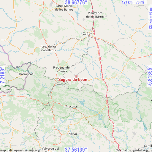
Segura de León GPS coordinates[2]
38° 7' 0.012" North, 6° 31' 0.012" West
| Map corner | latitude | longitude |
|---|---|---|
| Upper-left | 38.66776°, | -7.2198° |
| Center: | 38.11667°, | -6.51667° |
| Lower-right: | 37.56139°, | -5.81355° |
| Map W x H: | 123×123 km | = 76.4×76.4mi |
| max Lat: | 43.74134° ⇑87.7% North |
| Segura de León: | 38.11667° |
| min Lat: | ⇓12.3% South 27.64134° |
| min Long | Segura de León | max Long |
| -18.00367° | -6.51667° | 4.2899° |
| W 8.7%⇐ | ⇒91.3% E |
Elevation
Elevation of Segura de León is 668 m = 2192 ft, and this is 70 m = 230 ft above average elevation for this country.
| Max E: |
1682 m = 5518 ft | 49.1% |
| Segura de León | 668 m 2192 ft | |
| Avg. | 598 m = 1962 ft | |
Min E: |
0 m = 0 ft | 50.9% |
See also: Spain elevation on elevation.city.
Geographical zone
Segura de León is located in North temperate zone (between Tropic of Cancer and the Arctic Circle). Distance of this Northern Tropic circle is 1632.3 km =1014.3 mi to South.| Distance of | km | miles | from Segura de León |
|---|---|---|---|
| North Pole | 5768.9 | 3584.6 | to North |
| Arctic Circle | 3163 | 1965.4 | to North |
| Tropic Cancer | 1632.3 | 1014.3 | to South |
| Equator | 4238.2 | 2633.5 | to South |


Nearby cities:
15 places around Segura de León: (largest is in red/bold)
• Arroyomolinos de León
14.2 km =8.8 mi,  141°
141°
• Bodonal de la Sierra
5.1 km =3.2 mi,  312°
312°
• Cabeza la Vaca
9.5 km =5.9 mi,  112°
112°
• Calera de León
16.1 km =10 mi,  96°
96°
• Cañaveral de León
11.1 km =6.9 mi,  180°
180°
• Cortelazor
22.2 km =13.8 mi,  205°
205°
• Cumbres Mayores
12.8 km =8 mi,  241°
241°
• Fregenal de la Sierra
13.3 km =8.3 mi,  295°
295°
• Fuentes de León
5.7 km =3.5 mi,  199°
199°
• Higuera la Real
15.3 km =9.5 mi,  280°
280°
• Hinojales
14.2 km =8.8 mi, 204°
• Monesterio
22.2 km =13.8 mi, 99°
• Valdelarco
23.6 km =14.7 mi,  217°
217°
• Valencia del Ventoso
17.2 km =10.7 mi,  14°
14°
• Valverde de Burguillos
23.5 km =14.6 mi,  355°
355°
Sources, notices
• [Note1] Compared only with cities in Spain existing in our database
• [Src1] Map data: © OpenStreetMap contributors (CC-BY-SA)
• [Src2] Other city data from geonames.org with taken over terms of usage.
• [Src3] Geographical zone / Annual Mean Temperature by Robert A. Rohde @ Wikipedia
