La Santa geodata
La Santa (Canary Islands) is a populated place; located in Spain in Atlantic/Canary (GMT+1) time zone. With population of 922 people, there are 3048 cities with bigger population in this country. Compared to other cities in Spain, 98.4% of cities are located further ↑North; 98.6% of cities are located further →East and 97% of cities have higher elevation than La Santa. Note1
Administrative division(s):
- Level 1: Canary Islands
- Level 2: Provincia de Las Palmas
- Level 3: Tinajo


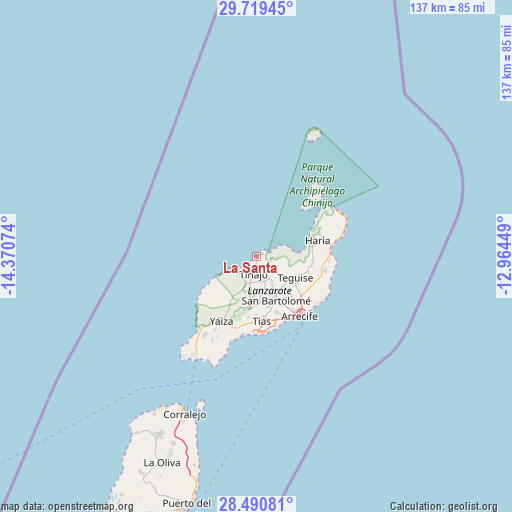
La Santa GPS coordinates[2]
29° 6' 25.056" North, 13° 40' 3.396" West
| Map corner | latitude | longitude |
|---|---|---|
| Upper-left | 29.71945°, | -14.37074° |
| Center: | 29.10696°, | -13.66761° |
| Lower-right: | 28.49081°, | -12.96449° |
| Map W x H: | 136.6×136.6 km | = 84.9×84.9mi |
| max Lat: | 43.74134° ⇑98.4% North |
| La Santa: | 29.10696° |
| min Lat: | ⇓1.6% South 27.64134° |
| min Long | La Santa | max Long |
| -18.00367° | -13.66761° | 4.2899° |
| W 1.4%⇐ | ⇒98.6% E |
Elevation
Elevation of La Santa is 15 m = 49 ft, and this is 583 m = 1913 ft below average elevation for this country.
| Max E: |
1682 m = 5518 ft | 97% |
| Avg. | 598 m = 1962 ft | |
| La Santa | 15 m = 49 ft | |
Min E: |
0 m = 0 ft | 3% |
See also: Spain elevation on elevation.city.
Geographical zone
La Santa is located in North temperate zone (between Tropic of Cancer and the Arctic Circle). Distance of this Northern Tropic circle is 630.5 km =391.8 mi to South.| Distance of | km | miles | from La Santa |
|---|---|---|---|
| North Pole | 6770.7 | 4207.1 | to North |
| Arctic Circle | 4164.8 | 2587.9 | to North |
| Tropic Cancer | 630.5 | 391.8 | to South |
| Equator | 3236.4 | 2011 | to South |


Nearby cities:
15 places around La Santa: (largest is in red/bold)
• Arrecife
19.8 km =12.3 mi,  143°
143°
• Costa Teguise
20.3 km =12.6 mi,  126°
126°
• Guatiza
18.7 km =11.6 mi,  101°
101°
• Haría
16.8 km =10.4 mi,  75°
75°
• Mala
19 km =11.8 mi,  93°
93°
• Mácher
17.8 km =11.1 mi,  187°
187°
• Nazaret
12.7 km =7.9 mi, 127°
• Puerto del Carmen
20.4 km =12.7 mi,  179°
179°
• San Bartolomé
12.9 km =8 mi,  155°
155°
• Soo
4.5 km =2.8 mi, 101°
• Teguise
11.3 km =7 mi,  117°
117°
• Tinajo
4.9 km =3 mi, 190°
• Tías
16.4 km =10.2 mi,  172°
172°
• Uga
19 km =11.8 mi,  203°
203°
• Yaiza
19.2 km =11.9 mi,  209°
209°
Sources, notices
• [Note1] Compared only with cities in Spain existing in our database
• [Src1] Map data: © OpenStreetMap contributors (CC-BY-SA)
• [Src2] Other city data from geonames.org with taken over terms of usage.
• [Src3] Geographical zone / Annual Mean Temperature by Robert A. Rohde @ Wikipedia
