Vizcaínos geodata
Vizcaínos (Castille and León) is a seat of a third-order administrative division; located in Spain in Europe/Madrid (GMT+2) time zone. With population of 54 people, there are 6416 cities with bigger population in this country. Compared to other cities in Spain, 76.6% of cities are located further ↓South; 50.8% of cities are located further ←West and 90.1% of cities have lower elevation than Vizcaínos. Note1
Administrative division(s):
- Level 1: Castille and León
- Level 2: Provincia de Burgos
- Level 3: Vizcaínos


Vizcaínos GPS coordinates[2]
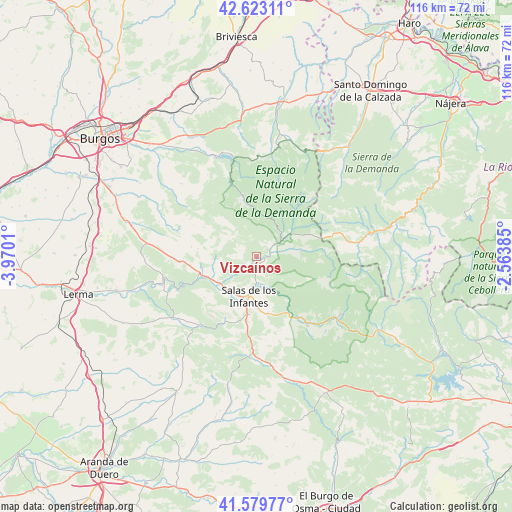
42° 6' 12.924" North, 3° 16' 1.128" West
| Map corner | latitude | longitude |
|---|---|---|
| Upper-left | 42.62311°, | -3.9701° |
| Center: | 42.10359°, | -3.26698° |
| Lower-right: | 41.57977°, | -2.56385° |
| Map W x H: | 116×116 km | = 72.1×72.1mi |
| max Lat: | 43.74134° ⇑23.4% North |
| Vizcaínos: | 42.10359° |
| min Lat: | ⇓76.6% South 27.64134° |
| min Long | Vizcaínos | max Long |
| -18.00367° | -3.26698° | 4.2899° |
| W 50.8%⇐ | ⇒49.2% E |
Elevation
Elevation of Vizcaínos is 1033 m = 3389 ft, and this is 435 m = 1427 ft above average elevation for this country.
| Max E: |
1682 m = 5518 ft | 9.9% |
| Vizcaínos | 1033 m 3389 ft | |
| Avg. | 598 m = 1962 ft | |
Min E: |
0 m = 0 ft | 90.1% |
See also: Spain elevation on elevation.city.
Geographical zone
Vizcaínos is located in North temperate zone (between Tropic of Cancer and the Arctic Circle). Distance of this Northern Tropic circle is 2075.6 km =1289.7 mi to South.| Distance of | km | miles | from Vizcaínos |
|---|---|---|---|
| North Pole | 5325.6 | 3309.2 | to North |
| Arctic Circle | 2719.7 | 1689.9 | to North |
| Tropic Cancer | 2075.6 | 1289.7 | to South |
| Equator | 4681.5 | 2908.9 | to South |


Nearby cities:
15 places around Vizcaínos: (largest is in red/bold)
• Barbadillo de Herreros
9 km =5.6 mi,  55°
55°
• Barbadillo del Mercado
10.3 km =6.4 mi,  225°
225°
• Barbadillo del Pez
3.6 km =2.2 mi, 62°
• Cascajares de la Sierra
11.9 km =7.4 mi,  246°
246°
• Castrillo de la Reina
13.2 km =8.2 mi,  168°
168°
• Hacinas
13.3 km =8.3 mi,  187°
187°
• Jaramillo Quemado
7.8 km =4.8 mi,  255°
255°
• Jaramillo de la Fuente
3.9 km =2.4 mi,  288°
288°
• Monasterio de la Sierra
8.4 km =5.2 mi,  133°
133°
• Pineda de la Sierra
12.7 km =7.9 mi,  348°
348°
• Pinilla de los Moros
6.3 km =3.9 mi, 231°
• Riocavado de la Sierra
7.9 km =4.9 mi,  46°
46°
• Salas de los Infantes
9.2 km =5.7 mi, 190°
• San Millán de Lara
7.4 km =4.6 mi,  299°
299°
• Villaespasa
11.3 km =7 mi,  267°
267°
Sources, notices
• [Note1] Compared only with cities in Spain existing in our database
• [Src1] Map data: © OpenStreetMap contributors (CC-BY-SA)
• [Src2] Other city data from geonames.org with taken over terms of usage.
• [Src3] Geographical zone / Annual Mean Temperature by Robert A. Rohde @ Wikipedia
