Villazala geodata
Villazala (Castille and León) is a seat of a third-order administrative division; located in Spain in Europe/Madrid (GMT+2) time zone. With population of 928 people, there are 3040 cities with bigger population in this country. Compared to other cities in Spain, 83.6% of cities are located further ↓South; 84% of cities are located further →East and 68.4% of cities have lower elevation than Villazala. Note1
Administrative division(s):
- Level 1: Castille and León
- Level 2: Provincia de León
- Level 3: Villazala


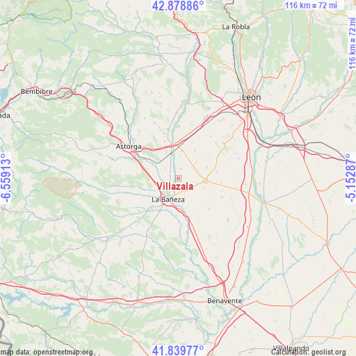
Villazala GPS coordinates[2]
42° 21' 41.256" North, 5° 51' 21.6" West
| Map corner | latitude | longitude |
|---|---|---|
| Upper-left | 42.87886°, | -6.55913° |
| Center: | 42.36146°, | -5.856° |
| Lower-right: | 41.83977°, | -5.15287° |
| Map W x H: | 115.5×115.5 km | = 71.8×71.8mi |
| max Lat: | 43.74134° ⇑16.4% North |
| Villazala: | 42.36146° |
| min Lat: | ⇓83.6% South 27.64134° |
| min Long | Villazala | max Long |
| -18.00367° | -5.856° | 4.2899° |
| W 16%⇐ | ⇒84% E |
Elevation
Elevation of Villazala is 801 m = 2628 ft, and this is 203 m = 666 ft above average elevation for this country.
| Max E: |
1682 m = 5518 ft | 31.6% |
| Villazala | 801 m 2628 ft | |
| Avg. | 598 m = 1962 ft | |
Min E: |
0 m = 0 ft | 68.4% |
See also: Spain elevation on elevation.city.
Geographical zone
Villazala is located in North temperate zone (between Tropic of Cancer and the Arctic Circle). Distance of this Northern Tropic circle is 2104.2 km =1307.5 mi to South.| Distance of | km | miles | from Villazala |
|---|---|---|---|
| North Pole | 5296.9 | 3291.3 | to North |
| Arctic Circle | 2691 | 1672.1 | to North |
| Tropic Cancer | 2104.2 | 1307.5 | to South |
| Equator | 4710.2 | 2926.8 | to South |


Nearby cities:
15 places around Villazala: (largest is in red/bold)
• Bustillo del Páramo
10.3 km =6.4 mi,  30°
30°
• Hospital de Órbigo
11.6 km =7.2 mi,  347°
347°
• La Bañeza
7.6 km =4.7 mi,  206°
206°
• Laguna Dalga
9.1 km =5.7 mi,  111°
111°
• Palacios de la Valduerna
7.7 km =4.8 mi,  240°
240°
• Regueras de Arriba
7.5 km =4.7 mi,  182°
182°
• Riego de la Vega
10.8 km =6.7 mi,  287°
287°
• San Cristóbal de la Polantera
5.3 km =3.3 mi,  307°
307°
• Santa Elena de Jamuz
11.5 km =7.1 mi,  193°
193°
• Santa María de la Isla
6 km =3.7 mi,  263°
263°
• Santa María del Páramo
8.6 km =5.3 mi,  94°
94°
• Soto de la Vega
3.9 km =2.4 mi, 213°
• Urdiales del Páramo
6.9 km =4.3 mi,  81°
81°
• Valdefuentes del Páramo
4.7 km =2.9 mi,  153°
153°
• Villarejo de Órbigo
10.2 km =6.3 mi,  336°
336°
Sources, notices
• [Note1] Compared only with cities in Spain existing in our database
• [Src1] Map data: © OpenStreetMap contributors (CC-BY-SA)
• [Src2] Other city data from geonames.org with taken over terms of usage.
• [Src3] Geographical zone / Annual Mean Temperature by Robert A. Rohde @ Wikipedia
