Villaprovedo geodata
Villaprovedo (Castille and León) is a seat of a third-order administrative division; located in Spain in Europe/Madrid (GMT+2) time zone. With population of 82 people, there are 6113 cities with bigger population in this country. Compared to other cities in Spain, 87.6% of cities are located further ↓South; 64.9% of cities are located further →East and 77.6% of cities have lower elevation than Villaprovedo. Note1
Administrative division(s):
- Level 1: Castille and León
- Level 2: Provincia de Palencia
- Level 3: Villaprovedo


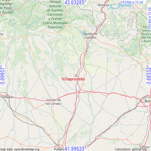
Villaprovedo GPS coordinates[2]
42° 31' 0.264" North, 4° 23' 47.22" West
| Map corner | latitude | longitude |
|---|---|---|
| Upper-left | 43.03285°, | -5.09957° |
| Center: | 42.51674°, | -4.39645° |
| Lower-right: | 41.99633°, | -3.69332° |
| Map W x H: | 115.3×115.2 km | = 71.6×71.6mi |
| max Lat: | 43.74134° ⇑12.4% North |
| Villaprovedo: | 42.51674° |
| min Lat: | ⇓87.6% South 27.64134° |
| min Long | Villaprovedo | max Long |
| -18.00367° | -4.39645° | 4.2899° |
| W 35.1%⇐ | ⇒64.9% E |
Elevation
Elevation of Villaprovedo is 875 m = 2871 ft, and this is 277 m = 909 ft above average elevation for this country.
| Max E: |
1682 m = 5518 ft | 22.4% |
| Villaprovedo | 875 m 2871 ft | |
| Avg. | 598 m = 1962 ft | |
Min E: |
0 m = 0 ft | 77.6% |
See also: Spain elevation on elevation.city.
Geographical zone
Villaprovedo is located in North temperate zone (between Tropic of Cancer and the Arctic Circle). Distance of this Northern Tropic circle is 2121.5 km =1318.2 mi to South.| Distance of | km | miles | from Villaprovedo |
|---|---|---|---|
| North Pole | 5279.6 | 3280.6 | to North |
| Arctic Circle | 2673.8 | 1661.4 | to North |
| Tropic Cancer | 2121.5 | 1318.2 | to South |
| Equator | 4727.4 | 2937.5 | to South |


Nearby cities:
15 places around Villaprovedo: (largest is in red/bold)
• Abia de las Torres
10.9 km =6.8 mi,  190°
190°
• Bárcena de Campos
9.1 km =5.7 mi,  246°
246°
• Calahorra de Boedo
6.4 km =4 mi,  8°
8°
• Castrillo de Villavega
9.8 km =6.1 mi,  225°
225°
• Espinosa de Villagonzalo
4.6 km =2.9 mi,  154°
154°
• Herrera de Pisuerga
10.2 km =6.3 mi,  31°
31°
• Olea de Boedo
11.3 km =7 mi,  336°
336°
• Páramo de Boedo
6.9 km =4.3 mi,  357°
357°
• Rezmondo
12.9 km =8 mi,  90°
90°
• San Cristóbal de Boedo
4.5 km =2.8 mi,  51°
51°
• Santa Cruz de Boedo
2.1 km =1.3 mi,  62°
62°
• Sotobañado y Priorato
8.9 km =5.5 mi, 335°
• Villameriel
6.6 km =4.1 mi,  281°
281°
• Villanuño de Valdavia
10.1 km =6.3 mi,  264°
264°
• Villasila de Valdavia
13.4 km =8.3 mi, 277°
Sources, notices
• [Note1] Compared only with cities in Spain existing in our database
• [Src1] Map data: © OpenStreetMap contributors (CC-BY-SA)
• [Src2] Other city data from geonames.org with taken over terms of usage.
• [Src3] Geographical zone / Annual Mean Temperature by Robert A. Rohde @ Wikipedia
