Rezmondo geodata
Rezmondo (Castille and León) is a seat of a third-order administrative division; located in Spain in Europe/Madrid (GMT+2) time zone. With population of 24 people, there are 6698 cities with bigger population in this country. Compared to other cities in Spain, 87.5% of cities are located further ↓South; 63.1% of cities are located further →East and 72.3% of cities have lower elevation than Rezmondo. Note1
Administrative division(s):
- Level 1: Castille and León
- Level 2: Provincia de Burgos
- Level 3: Rezmondo


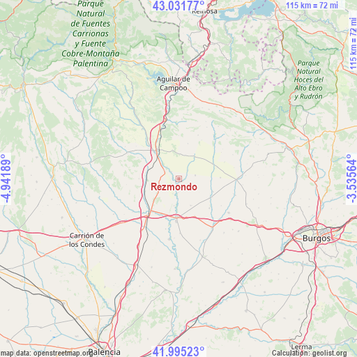
Rezmondo GPS coordinates[2]
42° 30' 56.34" North, 4° 14' 19.572" West
| Map corner | latitude | longitude |
|---|---|---|
| Upper-left | 43.03177°, | -4.94189° |
| Center: | 42.51565°, | -4.23877° |
| Lower-right: | 41.99523°, | -3.53564° |
| Map W x H: | 115.3×115.3 km | = 71.6×71.6mi |
| max Lat: | 43.74134° ⇑12.5% North |
| Rezmondo: | 42.51565° |
| min Lat: | ⇓87.5% South 27.64134° |
| min Long | Rezmondo | max Long |
| -18.00367° | -4.23877° | 4.2899° |
| W 36.9%⇐ | ⇒63.1% E |
Elevation
Elevation of Rezmondo is 829 m = 2720 ft, and this is 231 m = 758 ft above average elevation for this country.
| Max E: |
1682 m = 5518 ft | 27.7% |
| Rezmondo | 829 m 2720 ft | |
| Avg. | 598 m = 1962 ft | |
Min E: |
0 m = 0 ft | 72.3% |
See also: Spain elevation on elevation.city.
Geographical zone
Rezmondo is located in North temperate zone (between Tropic of Cancer and the Arctic Circle). Distance of this Northern Tropic circle is 2121.4 km =1318.2 mi to South.| Distance of | km | miles | from Rezmondo |
|---|---|---|---|
| North Pole | 5279.8 | 3280.7 | to North |
| Arctic Circle | 2673.9 | 1661.5 | to North |
| Tropic Cancer | 2121.4 | 1318.2 | to South |
| Equator | 4727.3 | 2937.4 | to South |


Nearby cities:
15 places around Rezmondo: (largest is in red/bold)
• Calahorra de Boedo
13.6 km =8.5 mi,  298°
298°
• Espinosa de Villagonzalo
11.7 km =7.3 mi,  249°
249°
• Grijalba
13.7 km =8.5 mi,  134°
134°
• Herrera de Pisuerga
11.6 km =7.2 mi,  319°
319°
• Melgar de Fernamental
12.4 km =7.7 mi,  182°
182°
• Osornillo
16.7 km =10.4 mi,  195°
195°
• Padilla de Abajo
13 km =8.1 mi,  156°
156°
• Padilla de Arriba
9.5 km =5.9 mi, 155°
• Páramo de Boedo
15 km =9.3 mi, 297°
• San Cristóbal de Boedo
9.8 km =6.1 mi,  287°
287°
• Santa Cruz de Boedo
11.1 km =6.9 mi,  275°
275°
• Sordillos
12.3 km =7.6 mi,  118°
118°
• Sotresgudo
8.7 km =5.4 mi,  35°
35°
• Villamayor de Treviño
11.6 km =7.2 mi, 122°
• Villaprovedo
12.9 km =8 mi,  270°
270°
Sources, notices
• [Note1] Compared only with cities in Spain existing in our database
• [Src1] Map data: © OpenStreetMap contributors (CC-BY-SA)
• [Src2] Other city data from geonames.org with taken over terms of usage.
• [Src3] Geographical zone / Annual Mean Temperature by Robert A. Rohde @ Wikipedia
