Villanueva de San Mancio geodata
Villanueva de San Mancio (Castille and León) is a seat of a third-order administrative division; located in Spain in Europe/Madrid (GMT+2) time zone. With population of 125 people, there are 5639 cities with bigger population in this country. Compared to other cities in Spain, 71.5% of cities are located further ↓South; 72.6% of cities are located further →East and 59.9% of cities have lower elevation than Villanueva de San Mancio. Note1
Administrative division(s):
- Level 1: Castille and León
- Level 2: Provincia de Valladolid
- Level 3: Villanueva de San Mancio
Current local time in Villanueva de San Mancio:
10:42 PM, ThursdayDifference from your time zone: hours


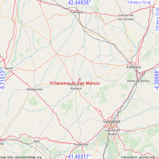
Villanueva de San Mancio GPS coordinates[2]
41° 55' 42.312" North, 5° 0' 43.2" West
| Map corner | latitude | longitude |
|---|---|---|
| Upper-left | 42.44938°, | -5.71513° |
| Center: | 41.92842°, | -5.012° |
| Lower-right: | 41.40317°, | -4.30888° |
| Map W x H: | 116.3×116.3 km | = 72.3×72.3mi |
| max Lat: | 43.74134° ⇑28.5% North |
| Villanueva de San Mancio: | 41.92842° |
| min Lat: | ⇓71.5% South 27.64134° |
| min Long | Villanueva de S | max Long |
| -18.00367° | -5.012° | 4.2899° |
| W 27.4%⇐ | ⇒72.6% E |
Elevation
Elevation of Villanueva de San Mancio is 744 m = 2441 ft, and this is 146 m = 479 ft above average elevation for this country.
| Max E: |
1682 m = 5518 ft | 40.1% |
| Villanueva de San Mancio | 744 m 2441 ft | |
| Avg. | 598 m = 1962 ft | |
Min E: |
0 m = 0 ft | 59.9% |
See also: Spain elevation on elevation.city.
Geographical zone
Villanueva de San Mancio is located in North temperate zone (between Tropic of Cancer and the Arctic Circle). Distance of this Northern Tropic circle is 2056.1 km =1277.6 mi to South.| Distance of | km | miles | from Villanueva de San Mancio |
|---|---|---|---|
| North Pole | 5345.1 | 3321.3 | to North |
| Arctic Circle | 2739.2 | 1702.1 | to North |
| Tropic Cancer | 2056.1 | 1277.6 | to South |
| Equator | 4662 | 2896.8 | to South |


Nearby cities:
15 places around Villanueva de San Mancio: (largest is in red/bold)
• Belmonte de Campos
2.6 km =1.6 mi,  53°
53°
• Berrueces
7.3 km =4.5 mi,  285°
285°
• Boada de Campos
13 km =8.1 mi,  58°
58°
• Capillas
13.8 km =8.6 mi, 46°
• Castil de Vela
7.6 km =4.7 mi,  34°
34°
• Gatón de Campos
13.7 km =8.5 mi,  10°
10°
• Medina de Ríoseco
5.7 km =3.5 mi,  207°
207°
• Meneses de Campos
7.8 km =4.8 mi,  79°
79°
• Moral de la Reina
8.1 km =5 mi,  322°
322°
• Palazuelo de Vedija
11 km =6.8 mi,  270°
270°
• Tamariz de Campos
5.5 km =3.4 mi,  350°
350°
• Valdenebro de los Valles
8.7 km =5.4 mi,  156°
156°
• Valverde de Campos
10.6 km =6.6 mi,  191°
191°
• Villabaruz de Campos
9.3 km =5.8 mi, 8°
• Villalba de los Alcores
14.5 km =9 mi,  119°
119°
Sources, notices
• [Note1] Compared only with cities in Spain existing in our database
• [Src1] Map data: © OpenStreetMap contributors (CC-BY-SA)
• [Src2] Other city data from geonames.org with taken over terms of usage.
• [Src3] Geographical zone / Annual Mean Temperature by Robert A. Rohde @ Wikipedia
