Tamames geodata
Tamames (Castille and León) is a seat of a third-order administrative division; located in Spain in Europe/Madrid (GMT+2) time zone. With population of 984 people, there are 2973 cities with bigger population in this country. Compared to other cities in Spain, 58.7% of cities are located further ↑North; 87.4% of cities are located further →East and 80.5% of cities have lower elevation than Tamames. Note1
Administrative division(s):
- Level 1: Castille and León
- Level 2: Provincia de Salamanca
- Level 3: Tamames


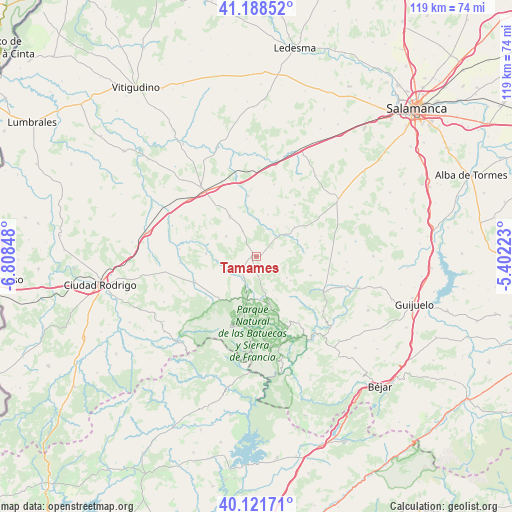
Tamames GPS coordinates[2]
40° 39' 26.1" North, 6° 6' 19.296" West
| Map corner | latitude | longitude |
|---|---|---|
| Upper-left | 41.18852°, | -6.80848° |
| Center: | 40.65725°, | -6.10536° |
| Lower-right: | 40.12171°, | -5.40223° |
| Map W x H: | 118.6×118.6 km | = 73.7×73.7mi |
| max Lat: | 43.74134° ⇑58.7% North |
| Tamames: | 40.65725° |
| min Lat: | ⇓41.3% South 27.64134° |
| min Long | Tamames | max Long |
| -18.00367° | -6.10536° | 4.2899° |
| W 12.6%⇐ | ⇒87.4% E |
Elevation
Elevation of Tamames is 902 m = 2959 ft, and this is 304 m = 997 ft above average elevation for this country.
| Max E: |
1682 m = 5518 ft | 19.5% |
| Tamames | 902 m 2959 ft | |
| Avg. | 598 m = 1962 ft | |
Min E: |
0 m = 0 ft | 80.5% |
See also: Spain elevation on elevation.city.
Geographical zone
Tamames is located in North temperate zone (between Tropic of Cancer and the Arctic Circle). Distance of this Northern Tropic circle is 1914.7 km =1189.7 mi to South.| Distance of | km | miles | from Tamames |
|---|---|---|---|
| North Pole | 5486.4 | 3409.1 | to North |
| Arctic Circle | 2880.5 | 1789.9 | to North |
| Tropic Cancer | 1914.7 | 1189.7 | to South |
| Equator | 4520.7 | 2809 | to South |


Nearby cities:
15 places around Tamames: (largest is in red/bold)
• Abusejo
6.5 km =4 mi,  332°
332°
• Aldeanueva de la Sierra
4.6 km =2.9 mi,  174°
174°
• Aldehuela de Yeltes
11.7 km =7.3 mi,  272°
272°
• Barbalos
13.9 km =8.6 mi,  81°
81°
• Berrocal de Huebra
11.2 km =7 mi,  52°
52°
• Cabrillas
11.1 km =6.9 mi, 326°
• Cereceda de la Sierra
10.2 km =6.3 mi, 173°
• Cilleros de la Bastida
9.8 km =6.1 mi,  157°
157°
• Escurial de la Sierra
13.4 km =8.3 mi,  109°
109°
• Nava de Francia
13.5 km =8.4 mi,  183°
183°
• Navarredonda de la Rinconada
9.7 km =6 mi,  125°
125°
• Puebla de Yeltes
7.3 km =4.5 mi,  241°
241°
• San Muñoz
14.1 km =8.8 mi,  352°
352°
• Sanchón de la Sagrada
11.7 km =7.3 mi,  35°
35°
• Tejeda y Segoyuela
7.5 km =4.7 mi, 112°
Sources, notices
• [Note1] Compared only with cities in Spain existing in our database
• [Src1] Map data: © OpenStreetMap contributors (CC-BY-SA)
• [Src2] Other city data from geonames.org with taken over terms of usage.
• [Src3] Geographical zone / Annual Mean Temperature by Robert A. Rohde @ Wikipedia
