San Leonardo de Yagüe geodata
San Leonardo de Yagüe (Castille and León) is a seat of a third-order administrative division; located in Spain in Europe/Madrid (GMT+2) time zone. With population of 2,354 people, there are 1968 cities with bigger population in this country. Compared to other cities in Spain, 69.4% of cities are located further ↓South; 53.3% of cities are located further ←West and 90.8% of cities have lower elevation than San Leonardo de Yagüe. Note1
Administrative division(s):
- Level 1: Castille and León
- Level 2: Provincia de Soria
- Level 3: San Leonardo de Yagüe
Current local time in San Leonardo de Yagüe:
09:35 PM, ThursdayDifference from your time zone: hours


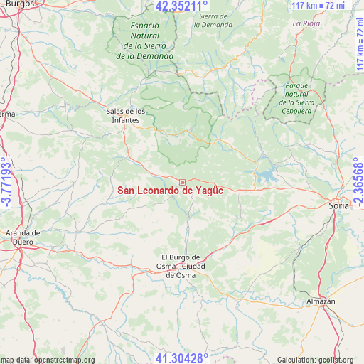
San Leonardo de Yagüe GPS coordinates[2]
41° 49' 49.224" North, 3° 4' 7.68" West
| Map corner | latitude | longitude |
|---|---|---|
| Upper-left | 42.35211°, | -3.77193° |
| Center: | 41.83034°, | -3.0688° |
| Lower-right: | 41.30428°, | -2.36568° |
| Map W x H: | 116.5×116.5 km | = 72.4×72.4mi |
| max Lat: | 43.74134° ⇑30.6% North |
| San Leonardo de Yagüe: | 41.83034° |
| min Lat: | ⇓69.4% South 27.64134° |
| min Long | San Leonardo de | max Long |
| -18.00367° | -3.0688° | 4.2899° |
| W 53.3%⇐ | ⇒46.7% E |
Elevation
Elevation of San Leonardo de Yagüe is 1045 m = 3428 ft, and this is 447 m = 1467 ft above average elevation for this country.
| Max E: |
1682 m = 5518 ft | 9.2% |
| San Leonardo de Yagüe | 1045 m 3428 ft | |
| Avg. | 598 m = 1962 ft | |
Min E: |
0 m = 0 ft | 90.8% |
See also: Spain elevation on elevation.city.
Geographical zone
San Leonardo de Yagüe is located in North temperate zone (between Tropic of Cancer and the Arctic Circle). Distance of this Northern Tropic circle is 2045.2 km =1270.8 mi to South.| Distance of | km | miles | from San Leonardo de Yagüe |
|---|---|---|---|
| North Pole | 5356 | 3328.1 | to North |
| Arctic Circle | 2750.1 | 1708.8 | to North |
| Tropic Cancer | 2045.2 | 1270.8 | to South |
| Equator | 4651.1 | 2890.1 | to South |


Nearby cities:
15 places around San Leonardo de Yagüe: (largest is in red/bold)
• Canicosa de la Sierra
12.1 km =7.5 mi,  11°
11°
• Casarejos
4.8 km =3 mi,  141°
141°
• Cubilla
14.2 km =8.8 mi,  129°
129°
• Espeja de San Marcelino
13.1 km =8.1 mi,  256°
256°
• Herrera de Soria
8.9 km =5.5 mi,  148°
148°
• Hontoria del Pinar
8 km =5 mi,  284°
284°
• Muriel Viejo
13.8 km =8.6 mi,  112°
112°
• Nafría de Ucero
12.2 km =7.6 mi,  190°
190°
• Navaleno
5.4 km =3.4 mi,  80°
80°
• Rabanera del Pinar
12.7 km =7.9 mi,  303°
303°
• Regumiel de la Sierra
15.5 km =9.6 mi,  25°
25°
• Santa María de las Hoyas
8.9 km =5.5 mi,  222°
222°
• Ucero
12.7 km =7.9 mi,  173°
173°
• Vadillo
6.6 km =4.1 mi, 131°
• Vilviestre del Pinar
13.4 km =8.3 mi,  356°
356°
Sources, notices
• [Note1] Compared only with cities in Spain existing in our database
• [Src1] Map data: © OpenStreetMap contributors (CC-BY-SA)
• [Src2] Other city data from geonames.org with taken over terms of usage.
• [Src3] Geographical zone / Annual Mean Temperature by Robert A. Rohde @ Wikipedia
