Ribota geodata
Ribota (Castille and León) is a seat of a third-order administrative division; located in Spain in Europe/Madrid (GMT+2) time zone. With population of 50 people, there are 6463 cities with bigger population in this country. Compared to other cities in Spain, 56.5% of cities are located further ↓South; 51.2% of cities are located further →East and 90% of cities have lower elevation than Ribota. Note1
Administrative division(s):
- Level 1: Castille and León
- Level 2: Provincia de Segovia
- Level 3: Ribota


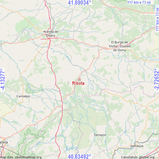
Ribota GPS coordinates[2]
41° 21' 53.172" North, 3° 25' 46.704" West
| Map corner | latitude | longitude |
|---|---|---|
| Upper-left | 41.89034°, | -4.13277° |
| Center: | 41.36477°, | -3.42964° |
| Lower-right: | 40.83492°, | -2.72652° |
| Map W x H: | 117.4×117.3 km | = 72.9×72.9mi |
| max Lat: | 43.74134° ⇑43.5% North |
| Ribota: | 41.36477° |
| min Lat: | ⇓56.5% South 27.64134° |
| min Long | Ribota | max Long |
| -18.00367° | -3.42964° | 4.2899° |
| W 48.8%⇐ | ⇒51.2% E |
Elevation
Elevation of Ribota is 1032 m = 3386 ft, and this is 434 m = 1424 ft above average elevation for this country.
| Max E: |
1682 m = 5518 ft | 10% |
| Ribota | 1032 m 3386 ft | |
| Avg. | 598 m = 1962 ft | |
Min E: |
0 m = 0 ft | 90% |
See also: Spain elevation on elevation.city.
Geographical zone
Ribota is located in North temperate zone (between Tropic of Cancer and the Arctic Circle). Distance of this Northern Tropic circle is 1993.4 km =1238.6 mi to South.| Distance of | km | miles | from Ribota |
|---|---|---|---|
| North Pole | 5407.7 | 3360.2 | to North |
| Arctic Circle | 2801.8 | 1741 | to North |
| Tropic Cancer | 1993.4 | 1238.6 | to South |
| Equator | 4599.3 | 2857.9 | to South |


Nearby cities:
15 places around Ribota: (largest is in red/bold)
• Alconada de Maderuelo
10.6 km =6.6 mi,  333°
333°
• Aldealengua de Santa María
11.3 km =7 mi,  343°
343°
• Ayllón
7.5 km =4.7 mi,  36°
36°
• Bercimuel
12.4 km =7.7 mi,  288°
288°
• Campo de San Pedro
12.1 km =7.5 mi,  306°
306°
• Cilleruelo de San Mamés
13.6 km =8.5 mi,  303°
303°
• Corral de Ayllón
3.8 km =2.4 mi,  320°
320°
• Fresno de Cantespino
5.8 km =3.6 mi,  273°
273°
• Grajera
15.3 km =9.5 mi, 273°
• Languilla
9.4 km =5.8 mi,  2°
2°
• Liceras
15.6 km =9.7 mi,  84°
84°
• Pajarejos
13.7 km =8.5 mi,  281°
281°
• Riaguas de San Bartolomé
8.5 km =5.3 mi, 324°
• Riaza
10.4 km =6.5 mi,  202°
202°
• Sequera de Fresno
9.7 km =6 mi, 271°
Sources, notices
• [Note1] Compared only with cities in Spain existing in our database
• [Src1] Map data: © OpenStreetMap contributors (CC-BY-SA)
• [Src2] Other city data from geonames.org with taken over terms of usage.
• [Src3] Geographical zone / Annual Mean Temperature by Robert A. Rohde @ Wikipedia
