Nestares geodata
Nestares (La Rioja) is a seat of a third-order administrative division; located in Spain in Europe/Madrid (GMT+2) time zone. In our database, there are 6762 cities with bigger population. Compared to other cities in Spain, 81.1% of cities are located further ↓South; 59.6% of cities are located further ←West and 76.6% of cities have lower elevation than Nestares. Note1


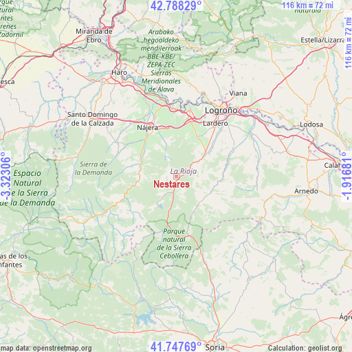
Nestares GPS coordinates[2]
42° 16' 12.504" North, 2° 37' 11.748" West
| Map corner | latitude | longitude |
|---|---|---|
| Upper-left | 42.78829°, | -3.32306° |
| Center: | 42.27014°, | -2.61993° |
| Lower-right: | 41.74769°, | -1.91681° |
| Map W x H: | 115.7×115.7 km | = 71.9×71.9mi |
| max Lat: | 43.74134° ⇑18.9% North |
| Nestares: | 42.27014° |
| min Lat: | ⇓81.1% South 27.64134° |
| min Long | Nestares | max Long |
| -18.00367° | -2.61993° | 4.2899° |
| W 59.6%⇐ | ⇒40.4% E |
Elevation
Elevation of Nestares is 866 m = 2841 ft, and this is 268 m = 879 ft above average elevation for this country.
| Max E: |
1682 m = 5518 ft | 23.4% |
| Nestares | 866 m 2841 ft | |
| Avg. | 598 m = 1962 ft | |
Min E: |
0 m = 0 ft | 76.6% |
See also: Spain elevation on elevation.city.
Geographical zone
Nestares is located in North temperate zone (between Tropic of Cancer and the Arctic Circle). Distance of this Northern Tropic circle is 2094.1 km =1301.2 mi to South.| Distance of | km | miles | from Nestares |
|---|---|---|---|
| North Pole | 5307.1 | 3297.7 | to North |
| Arctic Circle | 2701.2 | 1678.4 | to North |
| Tropic Cancer | 2094.1 | 1301.2 | to South |
| Equator | 4700 | 2920.4 | to South |


Nearby cities:
15 places around Nestares: (largest is in red/bold)
• Almarza de Cameros
6.2 km =3.9 mi,  163°
163°
• Cabezón de Cameros
11.6 km =7.2 mi,  134°
134°
• Castroviejo
7.4 km =4.6 mi,  332°
332°
• Gallinero de Cameros
10.9 km =6.8 mi,  179°
179°
• Ledesma de la Cogolla
9.9 km =6.2 mi,  304°
304°
• Muro en Cameros
8.9 km =5.5 mi,  124°
124°
• Nieva de Cameros
6.9 km =4.3 mi,  213°
213°
• Pedroso
8.8 km =5.5 mi,  291°
291°
• Pinillos
8.1 km =5 mi,  166°
166°
• Pradillo
10.6 km =6.6 mi,  189°
189°
• Santa Coloma
11.2 km =7 mi,  344°
344°
• Sorzano
11 km =6.8 mi,  42°
42°
• Torre en Cameros
9 km =5.6 mi,  110°
110°
• Torrecilla en Cameros
1.9 km =1.2 mi, 209°
• Viguera
8.4 km =5.2 mi,  58°
58°
Sources, notices
• [Note1] Compared only with cities in Spain existing in our database
• [Src1] Map data: © OpenStreetMap contributors (CC-BY-SA)
• [Src2] Other city data from geonames.org with taken over terms of usage.
• [Src3] Geographical zone / Annual Mean Temperature by Robert A. Rohde @ Wikipedia
