Lama geodata
Lama (Galicia) is a populated place; located in Spain in Europe/Madrid (GMT+2) time zone. With population of 2,864 people, there are 1768 cities with bigger population in this country. Compared to other cities in Spain, 84.8% of cities are located further ↓South; 97.2% of cities are located further →East and 62.5% of cities have higher elevation than Lama. Note1


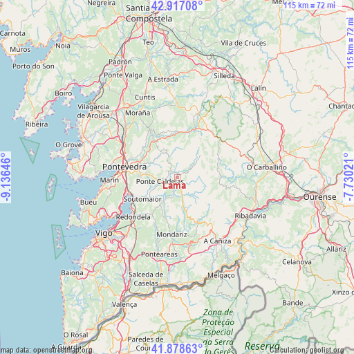
Lama GPS coordinates[2]
42° 24' 0" North, 8° 25' 59.988" West
| Map corner | latitude | longitude |
|---|---|---|
| Upper-left | 42.91708°, | -9.13646° |
| Center: | 42.4°, | -8.43333° |
| Lower-right: | 41.87863°, | -7.73021° |
| Map W x H: | 115.5×115.5 km | = 71.8×71.8mi |
| max Lat: | 43.74134° ⇑15.2% North |
| Lama: | 42.4° |
| min Lat: | ⇓84.8% South 27.64134° |
| min Long | Lama | max Long |
| -18.00367° | -8.43333° | 4.2899° |
| W 2.8%⇐ | ⇒97.2% E |
Elevation
Elevation of Lama is 493 m = 1617 ft, and this is 105 m = 344 ft below average elevation for this country.
| Max E: |
1682 m = 5518 ft | 62.5% |
| Avg. | 598 m = 1962 ft | |
| Lama | 493 m = 1617 ft | |
Min E: |
0 m = 0 ft | 37.5% |
See also: Spain elevation on elevation.city.
Geographical zone
Lama is located in North temperate zone (between Tropic of Cancer and the Arctic Circle). Distance of this Northern Tropic circle is 2108.5 km =1310.2 mi to South.| Distance of | km | miles | from Lama |
|---|---|---|---|
| North Pole | 5292.6 | 3288.7 | to North |
| Arctic Circle | 2686.7 | 1669.4 | to North |
| Tropic Cancer | 2108.5 | 1310.2 | to South |
| Equator | 4714.4 | 2929.4 | to South |


Nearby cities:
15 places around Lama: (largest is in red/bold)
• Avión
15.2 km =9.4 mi,  97°
97°
• Barro
23.2 km =14.4 mi,  318°
318°
• Combarro
22.7 km =14.1 mi,  278°
278°
• Covelo
19.8 km =12.3 mi,  159°
159°
• Forcarei
22.4 km =13.9 mi,  17°
17°
• Fornelos de Montes
6.7 km =4.2 mi,  193°
193°
• Marín
22 km =13.7 mi,  267°
267°
• Mondariz
18.9 km =11.7 mi, 186°
• Mondariz-Balneario
19.5 km =12.1 mi, 188°
• Moraña
20.7 km =12.9 mi, 323°
• Poio
19 km =11.8 mi, 279°
• Poio
21.4 km =13.3 mi, 284°
• Ponte Caldelas
5.8 km =3.6 mi,  257°
257°
• Pontevedra
17.7 km =11 mi, 281°
• Redondela
19.4 km =12.1 mi,  228°
228°
Sources, notices
• [Note1] Compared only with cities in Spain existing in our database
• [Src1] Map data: © OpenStreetMap contributors (CC-BY-SA)
• [Src2] Other city data from geonames.org with taken over terms of usage.
• [Src3] Geographical zone / Annual Mean Temperature by Robert A. Rohde @ Wikipedia
