Fontihoyuelo geodata
Fontihoyuelo (Castille and León) is a seat of a third-order administrative division; located in Spain in Europe/Madrid (GMT+2) time zone. With population of 43 people, there are 6531 cities with bigger population in this country. Compared to other cities in Spain, 78.2% of cities are located further ↓South; 73.3% of cities are located further →East and 70.4% of cities have lower elevation than Fontihoyuelo. Note1
Administrative division(s):
- Level 1: Castille and León
- Level 2: Provincia de Valladolid
- Level 3: Fontihoyuelo


Fontihoyuelo GPS coordinates[2]
42° 9' 42.912" North, 5° 3' 28.476" West
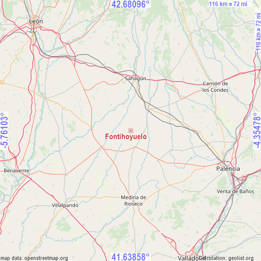
| Map corner | latitude | longitude |
|---|---|---|
| Upper-left | 42.68096°, | -5.76103° |
| Center: | 42.16192°, | -5.05791° |
| Lower-right: | 41.63858°, | -4.35478° |
| Map W x H: | 115.9×115.9 km | = 72×72mi |
| max Lat: | 43.74134° ⇑21.8% North |
| Fontihoyuelo: | 42.16192° |
| min Lat: | ⇓78.2% South 27.64134° |
| min Long | Fontihoyuelo | max Long |
| -18.00367° | -5.05791° | 4.2899° |
| W 26.7%⇐ | ⇒73.3% E |
Elevation
Elevation of Fontihoyuelo is 817 m = 2680 ft, and this is 219 m = 719 ft above average elevation for this country.
| Max E: |
1682 m = 5518 ft | 29.6% |
| Fontihoyuelo | 817 m 2680 ft | |
| Avg. | 598 m = 1962 ft | |
Min E: |
0 m = 0 ft | 70.4% |
See also: Spain elevation on elevation.city.
Geographical zone
Fontihoyuelo is located in North temperate zone (between Tropic of Cancer and the Arctic Circle). Distance of this Northern Tropic circle is 2082 km =1293.7 mi to South.| Distance of | km | miles | from Fontihoyuelo |
|---|---|---|---|
| North Pole | 5319.1 | 3305.1 | to North |
| Arctic Circle | 2713.2 | 1685.9 | to North |
| Tropic Cancer | 2082 | 1293.7 | to South |
| Equator | 4688 | 2913 | to South |


Nearby cities:
15 places around Fontihoyuelo: (largest is in red/bold)
• Bustillo de Chaves
4.4 km =2.7 mi,  219°
219°
• Cabezón de Valderaduey
8.4 km =5.2 mi,  274°
274°
• Castroponce
11 km =6.8 mi,  248°
248°
• Cuenca de Campos
11.4 km =7.1 mi,  178°
178°
• Herrín de Campos
9.6 km =6 mi,  115°
115°
• Melgar de Abajo
11.4 km =7.1 mi,  322°
322°
• Santervás de Campos
7.2 km =4.5 mi,  330°
330°
• Vega de Ruiponce
5.5 km =3.4 mi,  301°
301°
• Villacarralón
3.3 km =2.1 mi,  21°
21°
• Villacid de Campos
10.4 km =6.5 mi,  212°
212°
• Villacidaler
9.4 km =5.8 mi,  45°
45°
• Villagómez la Nueva
7 km =4.3 mi,  264°
264°
• Villalba de la Loma
11 km =6.8 mi,  277°
277°
• Villalón de Campos
7.2 km =4.5 mi,  164°
164°
• Villanueva de la Condesa
3.4 km =2.1 mi, 245°
Sources, notices
• [Note1] Compared only with cities in Spain existing in our database
• [Src1] Map data: © OpenStreetMap contributors (CC-BY-SA)
• [Src2] Other city data from geonames.org with taken over terms of usage.
• [Src3] Geographical zone / Annual Mean Temperature by Robert A. Rohde @ Wikipedia
