Herrín de Campos geodata
Herrín de Campos (Castille and León) is a seat of a third-order administrative division; located in Spain in Europe/Madrid (GMT+2) time zone. With population of 184 people, there are 5155 cities with bigger population in this country. Compared to other cities in Spain, 77.2% of cities are located further ↓South; 71.8% of cities are located further →East and 64.6% of cities have lower elevation than Herrín de Campos. Note1
Administrative division(s):
- Level 1: Castille and León
- Level 2: Provincia de Valladolid
- Level 3: Herrín de Campos


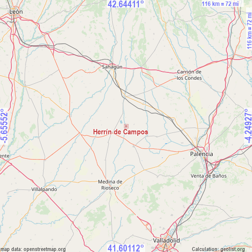
Herrín de Campos GPS coordinates[2]
42° 7' 29.136" North, 4° 57' 8.604" West
| Map corner | latitude | longitude |
|---|---|---|
| Upper-left | 42.64411°, | -5.65552° |
| Center: | 42.12476°, | -4.95239° |
| Lower-right: | 41.60112°, | -4.24927° |
| Map W x H: | 116×116 km | = 72.1×72.1mi |
| max Lat: | 43.74134° ⇑22.8% North |
| Herrín de Campos: | 42.12476° |
| min Lat: | ⇓77.2% South 27.64134° |
| min Long | Herrín de Camp | max Long |
| -18.00367° | -4.95239° | 4.2899° |
| W 28.2%⇐ | ⇒71.8% E |
Elevation
Elevation of Herrín de Campos is 775 m = 2543 ft, and this is 177 m = 581 ft above average elevation for this country.
| Max E: |
1682 m = 5518 ft | 35.4% |
| Herrín de Campos | 775 m 2543 ft | |
| Avg. | 598 m = 1962 ft | |
Min E: |
0 m = 0 ft | 64.6% |
See also: Spain elevation on elevation.city.
Geographical zone
Herrín de Campos is located in North temperate zone (between Tropic of Cancer and the Arctic Circle). Distance of this Northern Tropic circle is 2077.9 km =1291.1 mi to South.| Distance of | km | miles | from Herrín de Campos |
|---|---|---|---|
| North Pole | 5323.2 | 3307.7 | to North |
| Arctic Circle | 2717.3 | 1688.5 | to North |
| Tropic Cancer | 2077.9 | 1291.1 | to South |
| Equator | 4683.8 | 2910.4 | to South |


Nearby cities:
15 places around Herrín de Campos: (largest is in red/bold)
• Autillo de Campos
10.6 km =6.6 mi,  113°
113°
• Bustillo de Chaves
11.5 km =7.1 mi,  273°
273°
• Cisneros
13.2 km =8.2 mi,  36°
36°
• Cuenca de Campos
11.2 km =7 mi,  229°
229°
• Fontihoyuelo
9.6 km =6 mi,  295°
295°
• Frechilla
9.3 km =5.8 mi,  81°
81°
• Gatón de Campos
8.7 km =5.4 mi,  195°
195°
• Guaza de Campos
3.7 km =2.3 mi,  74°
74°
• Mazuecos de Valdeginate
10.4 km =6.5 mi,  62°
62°
• Villacarralón
10.4 km =6.5 mi,  314°
314°
• Villacidaler
11 km =6.8 mi,  349°
349°
• Villafrades de Campos
5.4 km =3.4 mi, 196°
• Villalón de Campos
7.3 km =4.5 mi,  247°
247°
• Villanueva de la Condesa
12.1 km =7.5 mi,  282°
282°
• Villarramiel
9.7 km =6 mi,  159°
159°
Sources, notices
• [Note1] Compared only with cities in Spain existing in our database
• [Src1] Map data: © OpenStreetMap contributors (CC-BY-SA)
• [Src2] Other city data from geonames.org with taken over terms of usage.
• [Src3] Geographical zone / Annual Mean Temperature by Robert A. Rohde @ Wikipedia
